Staverton - Gloucester
Airport details
| Country | United Kingdom |
| State | England |
| Region | EG |
| Airspace | London Ctr |
| Municipality | Tewkesbury |
| Elevation | 101ft (31m) |
| Timezone | GMT +0 |
| Coordinates | 51.89582, -2.16428 |
| Magnetic var | |
| Type | land |
| Available since | X-Plane v10.40 |
| ICAO code | EGBJ |
| IATA code | GLO |
| FAA code | n/a |
Communication
| Gloucester ATIS | 127.480 |
| Gloucester Tower | 122.905 |
| Gloucester RADAR | 120.980 |
| Gloucester Gloucester Approach | 128.555 |
| Gloucester Tower Departure | 122.905 |
Approach frequencies
| ILS-cat-I | RW27 | 109.95 | 18.00mi |
| 3.5° GS | RW27 | 109.95 | 18.00mi |
Nearby Points of Interest:
Badgeworth SSSI, Gloucestershire
-Innsworth Meadow
-Hillfield House
-Cheltenham Municipal Offices
-Thirlestaine House
-Northgate House And Attached Walls And Railings To Forecourt
-Leckhampton Court With Wall And Gate Piers
-Gloucester Court of Probate
-Gloucester Guildhall
-Number 20 And Part Of Abbey Precinct Wall
-St Nicholas' Church, Gloucester
-Kings Edwards Gate
-9 and 9A Southgate Street
-Winston Hall
-66, Westgate Street
-Gloucester Shire Hall
-Glevum
-Ladybellegate House
-Eastgate Shopping Centre
-Hyatt House
-Crown Courts
-Pittville Pump Room
-12-18, Brunswick Square
-Ashleworth Ham
-Crickley Hill and Barrow Wake
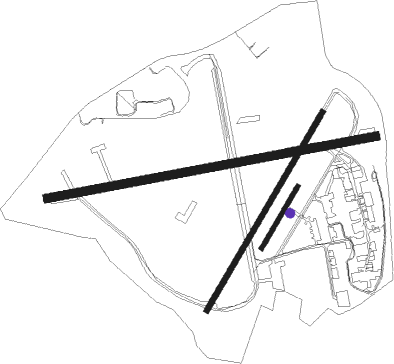
Runway info
Runway 09 / 27  | ||
| length | 1429m (4688ft) | |
| bearing | 86° / 266° | |
| width | 37m (121ft) | |
| surface | asphalt | |
| displ threshold | 30m (98ft) / 283m (928ft) | |
| Runway 04 / 22 | ||
| length | 980m (3215ft) | |
| bearing | 48° / 228° | |
| width | 23m (75ft) | |
| surface | asphalt | |
| displ threshold | 0m (0ft) / 87m (285ft) | |
| Runway 04R / 22L | ||
| length | 306m (1004ft) | |
| bearing | 48° / 228° | |
| width | 19m (62ft) | |
| surface | grass | |
Nearby beacons
| code | identifier | dist | bearing | frequency |
|---|---|---|---|---|
| GST | GLOUCESTERSHIRE NDB | 0.2 | 223° | 331 |
| FFA | FAIRFORD TACAN | 18.7 | 120° | 113.40 |
| BZ | BRIZE NORTON NDB | 22.6 | 105° | 386 |
| BZN | BRIZE NORTON TACAN | 22.6 | 105° | 111.90 |
| OF | FILTON NDB | 27.5 | 229° | 325 |
| OX | OXFORD NDB | 31.4 | 94° | 367 |
| HON | HONILEY VOR/DME | 33.2 | 47° | 113.65 |
| SH | SHOBDON NDB | 33.6 | 296° | 426 |
| BHX | BIRMINGHAM NDB | 36.8 | 36° | 406 |
| BRI | BRISTOL NDB | 37.1 | 227° | 414 |
| WBA | WOLVERHAMPTON NDB | 37.4 | 351° | 356 |
| WOL | DME | 37.4 | 351° | 108.60 |
| CPT | COMPTON VOR/DME | 42.7 | 113° | 114.35 |
| BDN | BOSCOMBE DOWN TACAN | 47.4 | 151° | 108.20 |
| VLN | YEOVILTON TACAN | 56.3 | 208° | 111 |
| TNL | TATENHILL NDB | 57 | 23° | 327 |
| SWB | SHAWBURY VOR/DME | 57.1 | 331° | 116.80 |
| WPL | WELSHPOOL NDB | 57.1 | 307° | 323 |
| YVL | DME | 60.2 | 207° | 109.05 |
| YVL | YEOVIL NDB | 60.3 | 208° | 343 |
| EMW | EAST MIDLANDS NDB | 61.7 | 37° | 393 |
| EAS | SOUTHAMPTON (EASTLEIGH) NDB | 64 | 139° | 391 |
| SAM | SOUTHAMPTON VOR/DME | 64.2 | 139° | 113.35 |
| EME | EAST MIDLANDS NDB | 66.5 | 46° | 353 |
Instrument approach procedures
| runway | airway (heading) | route (dist, bearing) |
|---|---|---|
| RW09 | KUPET (86°) | KUPET 3000ft BJ09I (5mi, 86°) 2500ft |
| RW09 | SOSAB (72°) | SOSAB 3000ft BJ09I (5mi, 21°) 2500ft |
| RW09 | UVNOP (99°) | UVNOP 3000ft BJ09I (5mi, 141°) 2500ft |
| RNAV | BJ09I 2500ft BJ09F (5mi, 86°) 1700ft EGBJ (5mi, 85°) 124ft (3119mi, 178°) 1500ft (turn) 2800ft GST (3118mi, 358°) 2800ft | |
| RW27 | LAPKU (249°) | LAPKU 2500ft NIRMO (5mi, 170°) 2500ft BJ27F (5mi, 266°) 2000ft |
| RW27 | NIRMO (267°) | NIRMO 2500ft BJ27F (5mi, 266°) 2000ft |
| RW27 | REKLO (283°) | REKLO 2500ft NIRMO (5mi, 350°) 2500ft BJ27F (5mi, 266°) 2000ft |
| RNAV | BJ27F 2000ft EGBJ (5mi, 267°) 127ft (3119mi, 178°) 1500ft GST (3118mi, 358°) 2800ft |
Disclaimer
The information on this website is not for real aviation. Use this data with the X-Plane flight simulator only! Data taken with kind consent from X-Plane 12 source code and data files. Content is subject to change without notice.