Dong Hoi
Airport details
| Country | Vietnam |
| State | Quang Binh province |
| Region | VV |
| Airspace | Hanoi Ctr |
| Municipality | Đồng Hới |
| Elevation | 0ft (0m) |
| Timezone | GMT +7 |
| Coordinates | 17.50250, 106.58444 |
| Magnetic var | |
| Type | land |
| Available since | X-Plane v11.55 |
| ICAO code | VVDH |
| IATA code | VDH |
| FAA code | n/a |
Communication
| Dong Hoi Tower | 118.700 |
| Dong Hoi Ha Noi Center | 125.900 |
Approach frequencies
| ILS-cat-I | RW29 | 110.3 | 18.00mi |
| 3° GS | RW29 | 110.3 | 18.00mi |
Runway info
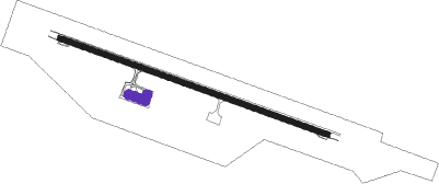
| Runway 11 / 29 | ||
| length | 2402m (7881ft) | |
| bearing | 113° / 293° | |
| width | 45m (148ft) | |
| surface | concrete | |
| blast zone | 100m (328ft) / 100m (328ft) | |
Nearby beacons
| code | identifier | dist | bearing | frequency |
|---|---|---|---|---|
| DOH | DONG HOI VOR/DME | 0.9 | 33° | 116.20 |
Departure and arrival routes
| Transition altitude | 9000ft |
| SID end points | distance | outbound heading | |
|---|---|---|---|
| RW11 | |||
| QUAT2A | 46mi | 130° | |
| DENG2A | 53mi | 327° | |
| RW29 | |||
| QUAT2B | 46mi | 130° | |
| DENG2B | 53mi | 327° | |
| STAR starting points | distance | inbound heading | |
|---|---|---|---|
| RW11 | |||
| KAMS1A | 53.1 | 147° | |
| KONC1A | 45.8 | 310° | |
| RW29 | |||
| KAMS1B | 53.1 | 147° | |
| KONC1B | 45.8 | 310° | |
Disclaimer
The information on this website is not for real aviation. Use this data with the X-Plane flight simulator only! Data taken with kind consent from X-Plane 12 source code and data files. Content is subject to change without notice.