Shelburne
Airport details
| Country | United States of America |
| State | Vermont |
| Region | |
| Airspace | Boston Ctr |
| Municipality | Shelburne |
| Elevation | 325ft (99m) |
| Timezone | GMT -5 |
| Coordinates | 44.35556, -73.22542 |
| Magnetic var | |
| Type | land |
| Available since | X-Plane v10.40 |
| ICAO code | VT8 |
| IATA code | n/a |
| FAA code | VT8 |
Communication
Nearby Points of Interest:
Lee Tracy House
-Tavern on Mutton Hill
-McNeil Homestead
-Cicero Goddard Peck House
-Abraham Aiken House
-Essex Village Historic District
-Sheldon-Owens Farm
-Old Chittenden County Courthouse
-South Union Street Historic District
-The Willsboro School
-Battery Street Historic District
-Lucy Ruggles House
-Edward Wells House
-Burlington Breakwater
-Willsboro Congregational Church
-United States Post Office and Customhouse
-Wells-Richardson Complex
-Winterbotham Estate
-Follett House
-Grasse Mount
-Daniel Webster Robinson House
-Fletcher Free Library
-Morrill Hall
-Ethan Allen Engine Company No. 4
-Edgewater Farm
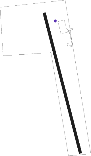
Runway info
| Runway 01 / 19 | ||
| length | 939m (3081ft) | |
| bearing | 346° / 166° | |
| width | 18m (60ft) | |
| surface | grass | |
Nearby beacons
| code | identifier | dist | bearing | frequency |
|---|---|---|---|---|
| BTV | BURLINGTON VOR/DME | 3 | 46° | 117.50 |
| BJA | BURLINGTON TACAN | 7.8 | 29° | 112.40 |
| BT | HERRO (BURLINGTON) NDB | 10.6 | 352° | 382 |
| MPV | MONTPELIER VOR/DME | 37.1 | 109° | 116.90 |
| DYO | SMUTO (RUTLAND) NDB | 40.6 | 158° | 221 |
| SLK | LAKE DME | 42 | 272° | 109.20 |
| RUT | DME | 51.1 | 162° | 111 |
| YJN | DME | 54.2 | 354° | 115.80 |
| CNH | CLAREMONT NDB | 69.8 | 139° | 233 |
Disclaimer
The information on this website is not for real aviation. Use this data with the X-Plane flight simulator only! Data taken with kind consent from X-Plane 12 source code and data files. Content is subject to change without notice.