Zarzal - San Marino
Airport details
| Country | Colombia |
| State | Valle del Cauca |
| Region | |
| Airspace | Bogota Ctr |
| Municipality | Zarzal |
| Elevation | 3042ft (927m) |
| Timezone | GMT -5 |
| Coordinates | 4.38237, -76.07774 |
| Magnetic var | |
| Type | land |
| Available since | X-Plane v10.40 |
| ICAO code | SK54 |
| IATA code | n/a |
| FAA code | n/a |
Communication
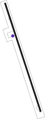
Runway info
| Runway 17 / 35 | ||
| length | 1432m (4698ft) | |
| bearing | 166° / 346° | |
| width | 18m (60ft) | |
| surface | asphalt | |
| blast zone | 18m (59ft) / 30m (98ft) | |
Nearby beacons
| code | identifier | dist | bearing | frequency |
|---|---|---|---|---|
| AXM | ARMENIA VOR/DME | 19.2 | 76° | 111.60 |
| ULQ | TULUA VOR/DME | 19.6 | 207° | 117.70 |
| PEI | PEREIRA VOR/DME | 28 | 31° | 116 |
| MZL | MANIZALES VOR/DME | 52 | 39° | 112.10 |
| IBG | IBAGUE VOR/DME | 58.1 | 89° | 113.10 |
| CLO | CALI VOR/DME | 62 | 198° | 115.50 |
| BUN | BUENAVENTURA VOR/DME | 64.3 | 239° | 113.80 |
Disclaimer
The information on this website is not for real aviation. Use this data with the X-Plane flight simulator only! Data taken with kind consent from X-Plane 12 source code and data files. Content is subject to change without notice.