Boyne City - Boyne City Muni
Airport details
| Country | United States of America |
| State | Michigan |
| Region | K5 |
| Airspace | Minneapolis Ctr |
| Municipality | Boyne City |
| Elevation | 659ft (201m) |
| Timezone | GMT -5 |
| Coordinates | 45.20881, -84.98988 |
| Magnetic var | |
| Type | land |
| Available since | X-Plane v10.40 |
| ICAO code | N98 |
| IATA code | n/a |
| FAA code | N98 |
Communication
| Boyne City Muni CTAF/UNICOM | 122.800 |
Nearby Points of Interest:
Boyne City Central Historic District
-Boyne City Water Works Building
-Ernest Hemingway Cottage
-Horton Bay School
-Horton Bay General Store
-Votruba Block
-East Jordan Lumber Company Store Building
-Frank Lesher House
-I. N. Debenham House
-Bert and John Hobbins House
-A. Malin House
-Sarah Pennington House
-John Nyman House
-Phillip Rehkopf House
-Elias Meyers House
-Gerhard Fochtman House
-Hosman and Wheeler Meat Market
-Grace Methodist Episcopal Church
-Jacob Miller House
-W. S. Carmichael House
-John Kabler House
-Trinity Evangelical Church
-Stout House
-Petoskey Grocery Company Building
-J. B. Allen House
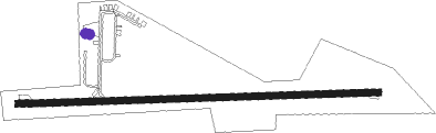
Runway info
| Runway 9 / 27 | ||
| length | 1217m (3993ft) | |
| bearing | 92° / 272° | |
| width | 23m (75ft) | |
| surface | asphalt | |
| displ threshold | 183m (600ft) / 0m (0ft) | |
Nearby beacons
| code | identifier | dist | bearing | frequency |
|---|---|---|---|---|
| GL | BANGU (GAYLORD) NDB | 13.9 | 137° | 375 |
| GLR | GAYLORD VOR/DME | 16.8 | 125° | 109.20 |
| GYG | GRAYLING NDB | 28.4 | 161° | 359 |
| PLN | PELLSTON VORTAC | 28.8 | 38° | 111.80 |
| CGG | GRAYLING VOR | 33.5 | 154° | 109.80 |
| TV | GWENN (TRAVERSE CITY) NDB | 34 | 223° | 365 |
| TVC | TRAVERSE CITY VOR/DME | 40.2 | 226° | 114.60 |
| MA | WEXOR (CADILLAC) NDB | 63 | 210° | 336 |
Instrument approach procedures
| runway | airway (heading) | route (dist, bearing) |
|---|---|---|
| RW09 | ADENO (52°) | ADENO ZANUG (11mi, 360°) 2600ft ZANUG (turn) 2500ft |
| RW09 | GLR (305°) | GLR ZANUG (25mi, 292°) 3000ft ZANUG (turn) 2500ft |
| RW09 | PLN (218°) | PLN ZANUG (34mi, 233°) 2800ft ZANUG (turn) 2500ft |
| RNAV | ZANUG 2500ft AKRIF (4mi, 92°) 2500ft OZKIW (4mi, 92°) 1360ft N98 (2mi, 92°) 695ft (5193mi, 118°) 1060ft VEBHA (5191mi, 298°) WOMOP (11mi, 81°) 3200ft WOMOP (turn) | |
| RW27 | WOMOP (263°) | WOMOP 6000ft WOMOP (turn) 3200ft |
| RNAV | WOMOP 3200ft UHOZA (7mi, 255°) 2500ft KIYRE (3mi, 272°) 1540ft N98 (3mi, 272°) 696ft (5193mi, 118°) 1060ft YOVUG (5196mi, 298°) ADENO (13mi, 223°) 3000ft ADENO (turn) |
Disclaimer
The information on this website is not for real aviation. Use this data with the X-Plane flight simulator only! Data taken with kind consent from X-Plane 12 source code and data files. Content is subject to change without notice.