Cascais
Airport details
| Country | Portugal |
| State | Lisbon District |
| Region | LP |
| Airspace | Lisbon Ctr |
| Municipality | São Domingos de Rana |
| Elevation | 326ft (99m) |
| Timezone | GMT +0 |
| Coordinates | 38.72602, -9.35665 |
| Magnetic var | |
| Type | land |
| Available since | X-Plane v10.40 |
| ICAO code | LPCS |
| IATA code | CAT |
| FAA code | n/a |
Communication
| Cascais Ground Control | 121.825 |
| Cascais Tower | 120.300 |
Nearby Points of Interest:
Cascais Municipal Aerodrome
-Quinta das Cruzadas
-Quinta de Santo António
-Igreja da Penha Longa
-Cortinas de Atiradores
-Bases da muralha de Cascais
-Palácio dos Arcos
-Quinta da Bela Vista
-Forte de Santa Marta
-Museum of Brinquedo
-Chalet da Condessa de Edla
-Casa-Museu Leal da Câmara
-Jardins, esculturas e duas salas com pintura decorativa, no antigo Paço Real de Caxias
-Cultural Landscape of Sintra
-Quinta do Relógio
-Fort of Nossa Senhora da Guia
-Centro Desportivo Nacional do Jamor
-Santa Cruz Hospital
-Aqueduto do Caneiro
-Hospital of St. Francis Xavier
-Centro Comercial do Restelo
-Monastery of the Hieronymites and Tower of Belém in Lisbon
-Praça do Império
-Centro Hospitalar de Lisboa Ocidental
-Bairro Grandela
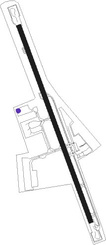
Runway info
| Runway 17 / 35 | ||
| length | 1402m (4600ft) | |
| bearing | 160° / 340° | |
| width | 30m (98ft) | |
| surface | asphalt | |
| displ threshold | 190m (623ft) / 0m (0ft) | |
Nearby beacons
| code | identifier | dist | bearing | frequency |
|---|---|---|---|---|
| CAS | CASCAIS VOR/DME | 1.3 | 346° | 114.30 |
| SRA | SINTRA VORTAC | 6.2 | 9° | 112.10 |
| STR | SINTRA NDB | 9.5 | 344° | 371 |
| LIS | LISBON VOR/DME | 13.2 | 50° | 114.80 |
| MOJ | MONTIJO TACAN | 15.1 | 93° | 110 |
| ESP | ESPICHEL VOR/DME | 19.8 | 150° | 112.50 |
| LAR | ARRUDA (LISBON) NDB | 21.8 | 50° | 382 |
| ARR | DME-ILS | 23.2 | 121° | 108.30 |
| FTM | FATIMA VOR/DME | 69.2 | 43° | 113.50 |
Departure and arrival routes
| Transition altitude | 4000ft |
| SID end points | distance | outbound heading | |
|---|---|---|---|
| RW17 | |||
| ESP8S | 20mi | 150° | |
| RW35 | |||
| ESP3N | 20mi | 150° | |
| STAR starting points | distance | inbound heading | |
|---|---|---|---|
| RW35 | |||
| ROCA4N | 69.2 | 223° | |
Instrument approach procedures
| runway | airway (heading) | route (dist, bearing) |
|---|---|---|
| RW35 | CEFOX (15°) | CEFOX 3000ft OXFIN (5mi, 77°) 2000ft |
| RNAV | OXFIN 2000ft ZEZZU (4mi, 340°) 2000ft LPCS (6mi, 339°) 327ft CS460 (8mi, 266°) EKMAR (9mi, 180°) 3000ft EKMAR (turn) 3000ft |
Holding patterns
| STAR name | hold at | type | turn | heading* | altitude | leg | speed limit |
|---|---|---|---|---|---|---|---|
| ROCA4N | FD35 | VHF | left | 169 (349)° | > 2000ft | 1.0min timed | ICAO rules |
| *) magnetic outbound (inbound) holding course | |||||||
Disclaimer
The information on this website is not for real aviation. Use this data with the X-Plane flight simulator only! Data taken with kind consent from X-Plane 12 source code and data files. Content is subject to change without notice.