Moravská Třebová - Moravska Trebova
Airport details
| Country | Czechia |
| State | Northeast |
| Region | LK |
| Airspace | Prague Ctr |
| Municipality | Staré Město |
| Elevation | 1320ft (402m) |
| Timezone | GMT +1 |
| Coordinates | 49.79833, 16.68778 |
| Magnetic var | |
| Type | land |
| Available since | X-Plane v10.40 |
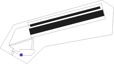
| ICAO code | LKMK |
| IATA code | n/a |
| FAA code | n/a |
Communication
| Moravska Trebova INFO | 130.550 |
Nearby Points of Interest:
Church of Saint Catherine (Staré Město)
-Pomník nacistických obětí
-Chapels on Křížový vrch
-Schody mrtvých
-Povodňové desky
-Rychnov na Moravě church t.
-Latin School (Moravská Třebová)
-Radkov Castle
-Church of Saint Stanislaus
-Křížová cesta (Koclířov)
-kostel svaté Maří Magdalény
-Church of Saint Wenceslaus
-zámek Lanškroun
-Tvrz Nemile
-Church of Saint George
-Kaple svatého Ducha
-Zábřeh na Moravě Castle
-Maria column (Zábřeh)
-City walls of Svitavy
-Langer's Villa
-Church of Saint Stanislaus (Mohelnice)
-Českobratrská modlitebna
-Church of Saint Nicholas
-Vodní elektrárna J. Plhák
-Church of Saint Leonard

Nearby beacons
| code | identifier | dist | bearing | frequency |
|---|---|---|---|---|
| PK | PARDUBICE NDB | 36.1 | 284° | 432 |
| P | PARDUBICE NDB | 37.7 | 283° | 888 |
| BNO | BRNO VOR/DME | 38.9 | 180° | 114.45 |
| B | BOREK (BRNO) NDB | 39 | 177° | 429 |
| XU | NAMEST NDB | 43.4 | 226° | 563 |
| X | NAMEST NDB | 43.6 | 224° | 362 |
| L | NAMEST NDB | 44.1 | 220° | 362 |
| LA | NAMEST NDB | 44.4 | 218° | 514 |
| KUN | KUNOVICE NDB | 51.9 | 130° | 416 |
| KNE | KUNOVICE NDB | 54.1 | 135° | 434 |
Disclaimer
The information on this website is not for real aviation. Use this data with the X-Plane flight simulator only! Data taken with kind consent from X-Plane 12 source code and data files. Content is subject to change without notice.