Airports for X-Plane offers a convenient way to explore airports and their related communication information for the X-Plane flight simulator. It only uses data from the X-Plane flight simulator itself, and is therefore more reliable than the data that comes from real aviation websites. You can search for airports by using the ICAO code, or browse for airports per country and state. The information displayed is categorized by airport details, runway information, airport communication, approach frequencies (ILS and Glidepath details), details of nearby beacons, SIDs, STARs and approach procedures.

customs takeoff taxiway runway consulate stol airstrip airfield traffic pattern military city local government southwest stolport airliner train train station flight downtown plane arrival

Moravská Třebová - Moravska Trebova

Airport details

CountryCzechia
StateNortheast
RegionLK
AirspacePrague Ctr
MunicipalityStaré Město
Elevation1320ft (402m)
TimezoneGMT +1
Coordinates49.79833, 16.68778
Magnetic var
Typeland
Available sinceX-Plane v10.40
ICAO codeLKMK
IATA coden/a
FAA coden/a

Communication

Moravska Trebova INFO130.550
Nearby Points of Interest:
Church of Saint Catherine (Staré Město)
-
Pomník nacistických obětí
-
Chapels on Křížový vrch
-
Schody mrtvých
-
Povodňové desky
-
Rychnov na Moravě church t.
-
Latin School (Moravská Třebová)
-
Radkov Castle
-
Church of Saint Stanislaus
-
Křížová cesta (Koclířov)
-
kostel svaté Maří Magdalény
-
Church of Saint Wenceslaus
-
zámek Lanškroun
-
Tvrz Nemile
-
Church of Saint George
-
Kaple svatého Ducha
-
Zábřeh na Moravě Castle
-
Maria column (Zábřeh)
-
City walls of Svitavy
-
Langer's Villa
-
Church of Saint Stanislaus (Mohelnice)
-
Českobratrská modlitebna
-
Church of Saint Nicholas
-
Vodní elektrárna J. Plhák
-
Church of Saint Leonard

Runway info

Runway 08L / 26R  
 length712m (2336ft)
 bearing83° / 263°
 width23m (75ft)
 surfaceasphalt
Runway 08R / 26L  
 length712m (2336ft)
 bearing83° / 263°
 width60m (197ft)
 surfacegrass

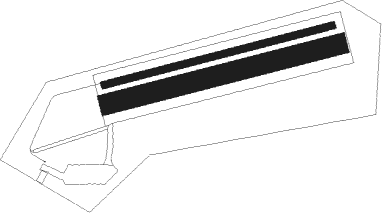
Airport layout


Parking locations

Nearby beacons

codeidentifierdistbearingfrequency
PKPARDUBICE NDB36.1284°432
PPARDUBICE NDB37.7283°888
BNOBRNO VOR/DME38.9180°114.45
BBOREK (BRNO) NDB39177°429
XUNAMEST NDB43.4226°563
XNAMEST NDB43.6224°362
LNAMEST NDB44.1220°362
LANAMEST NDB44.4218°514
KUNKUNOVICE NDB51.9130°416
KNEKUNOVICE NDB54.1135°434

Disclaimer

The information on this website is not for real aviation. Use this data with the X-Plane flight simulator only! Data taken with kind consent from X-Plane 12 source code and data files. Content is subject to change without notice.