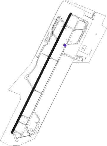
Grosetto - Grosseto
Airport details
| Country | Italy |
| State | Tuscany |
| Region | LI |
| Airspace | Rome Ctr |
| Municipality | Grosseto |
| Elevation | 15ft (5m) |
| Timezone | GMT +1 |
| Coordinates | 42.75975, 11.07190 |
| Magnetic var | |
| Type | land |
| Available since | X-Plane v10.32 |
| ICAO code | LIRS |
| IATA code | GRS |
| FAA code | n/a |
Communication
| Grosseto Tower | 128.100 |
| Grosseto Tower | 122.100 |
| Grosseto Approach | 122.100 |
| Grosseto Approach | 124.525 |
Approach frequencies
| ILS-cat-I | RW03L | 111.15 | 18.00mi |
| 3° GS | RW03L | 111.15 | 18.00mi |
Nearby Points of Interest:
Rusellae
-Santi Cerbone e Michele
-Punta Ala e isolotto dello Sparviero
-San Pietro all'Orto
-Palazzo Malfatti
-Palazzo del Comune
-Palazzetto delle Armi
-Casa Fedi
-San Bartolomeo
-Laguna di Orbetello
-San Niccolò
-Giardino di Piero Bonacina
-convento dei Cappuccini
-Walls of Montegiovi
-Palazzo Nerucci
-San Giuseppe
-Santi Michele e Paolo, Montieri
-San Francesco
-Palazzo Sforza Cesarini
-Santi Giusto e Clemente
-Madonna delle Grazie
-Santa Croce
-Santa Maria Assunta alla Befa
-convento dell’Osservanza
Nearby beacons
| code | identifier | dist | bearing | frequency |
|---|---|---|---|---|
| GRO | GROSSETO VORTAC | 0.2 | 78° | 109.85 |
| ELB | ELBA VORTAC | 29.8 | 268° | 114.70 |
| TAQ | TARQUINIA VOR/DME | 43.8 | 130° | 111.80 |
| VIB | VITERBO NDB | 47.5 | 108° | 480 |
| PIS | PISA NDB | 60.2 | 317° | 379 |
| PIS | PISA VOR/DME | 62.5 | 323° | 112.10 |
| PIN | PISA TACAN | 64.1 | 326° | 108.30 |
Departure and arrival routes
| Transition altitude | 6000ft |
| SID end points | distance | outbound heading | |
|---|---|---|---|
| RW03L | |||
| GIKI7S | 44mi | 98° | |
| BAMV5S | 15mi | 200° | |
| UPAD5S | 15mi | 268° | |
| LOME5S | 76mi | 357° | |
| RW21R | |||
| GIKI7W | 44mi | 98° | |
| BAMV5W | 15mi | 200° | |
| UPAD5W | 15mi | 268° | |
| LOME5W | 76mi | 357° | |
| STAR starting points | distance | inbound heading | |
|---|---|---|---|
| RW03L | |||
| BAMV1B, BAMV1E | 14.9 | 20° | |
| UPAD1E, UPAD1B | 14.7 | 88° | |
| PIS1B, PIS1E | 60.2 | 137° | |
| LOME1B, LOME1E | 76.1 | 177° | |
| GIKI3B, GIKI1E | 43.9 | 278° | |
Holding patterns
| STAR name | hold at | type | turn | heading* | altitude | leg | speed limit |
|---|---|---|---|---|---|---|---|
| BAMV1B | GRO | NDB | left | 65 (245)° | > 3000ft | 1.0min timed | ICAO rules |
| BAMV1E | MEFFE | VHF | right | 350 (170)° | > 3000ft | DME 4.0mi | 265 |
| GIKI1E | MEFFE | VHF | right | 350 (170)° | > 3000ft | DME 4.0mi | 265 |
| GIKI3B | GRO | NDB | left | 65 (245)° | > 3000ft | 1.0min timed | ICAO rules |
| LOME1B | GRO | NDB | left | 65 (245)° | > 3000ft | 1.0min timed | ICAO rules |
| LOME1E | MEFFE | VHF | right | 350 (170)° | > 3000ft | DME 4.0mi | 265 |
| PIS1B | GRO | NDB | left | 65 (245)° | > 3000ft | 1.0min timed | ICAO rules |
| PIS1E | MEFFE | VHF | right | 350 (170)° | > 3000ft | DME 4.0mi | 265 |
| UPAD1B | GRO | NDB | left | 65 (245)° | > 3000ft | 1.0min timed | ICAO rules |
| UPAD1E | MEFFE | VHF | right | 350 (170)° | > 3000ft | DME 4.0mi | 265 |
| *) magnetic outbound (inbound) holding course | |||||||
Disclaimer
The information on this website is not for real aviation. Use this data with the X-Plane flight simulator only! Data taken with kind consent from X-Plane 12 source code and data files. Content is subject to change without notice.