Pau - Pau Pyrenees
Airport details
| Country | France |
| State | Nouvelle-Aquitaine |
| Region | LF |
| Airspace | Bordeaux Ctr |
| Municipality | Sauvagnon |
| Elevation | 616ft (188m) |
| Timezone | GMT +1 |
| Coordinates | 43.37067, -0.41220 |
| Magnetic var | |
| Type | land |
| Available since | X-Plane v10.40 |
| ICAO code | LFBP |
| IATA code | PUF |
| FAA code | n/a |
Communication
| Pau Pyrenees Pau ATIS | 128.475 |
| Pau Pyrenees Pau Ground Control | 121.750 |
| Pau Pyrenees Pau Tower | 124.150 |
| Pau Pyrenees Pyrenees Approach | 121.175 |
| Pau Pyrenees Pau Pyrenees Approach | 128.800 |
Approach frequencies
| ILS-cat-III | RW31 | 110.1 | 18.00mi |
| 3° GS | RW31 | 110.1 | 18.00mi |
Nearby Points of Interest:
Église Saint-Jean-Baptiste de Poey-de-Lescar
-Musée Bernadotte
-Commanderie de Caubin
-abbey of Sauvelade
-Maison carrée de Nay
-hôtel Pouts
-Temple protestant d'Orthez
-Tour de Maubourguet
-Halle aux grains d'Aire-sur-l'Adour
-Town hall of Aire-sur-l'Adour
-Église d'Espès
-château de Tostat
-Prefecture hotel of Hautes-Pyrénées
-Chemin de croix des Espélugues
-Haras national de Tarbes
-Thermes de Salies-de-Béarn
-Ancienne église Saint-Paul de Saint-Palais
-Église Sainte-Madeleine de Saint-Palais
-Église Saint-Étienne d'Arhansus
-Église Saint-Martin d'Orignac
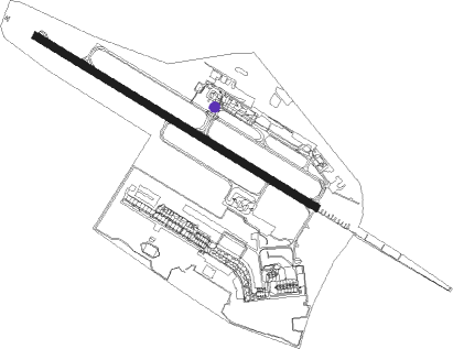
Runway info
| Runway 13 / 31 | ||
| length | 2497m (8192ft) | |
| bearing | 118° / 298° | |
| width | 60m (197ft) | |
| surface | asphalt | |
| blast zone | 8m (26ft) / 13m (43ft) | |
Nearby beacons
| code | identifier | dist | bearing | frequency |
|---|---|---|---|---|
| PU | PAU/PYRENEES NDB | 5.5 | 115° | 364 |
| PO | PAU/PYRENEES NDB | 11.2 | 103° | 397 |
| LMB | LEMBEYE VOR | 18.1 | 76° | 111.80 |
| TL | TARBES NDB | 20.7 | 100° | 321 |
| TBO | TARBES VOR/DME | 24.4 | 94° | 113.90 |
| LGH | MARSAN (MONT-DE-MARSAN) VOR/DME | 32.6 | 351° | 111.65 |
| MDM | MARSAN (MONT-DE-MARSAN) TACAN | 32.6 | 350° | 108.70 |
| DX | DAX SEYRESSE NDB | 33.2 | 298° | 334 |
| BZ | BIARRITZ PAYS BASQUE NDB | 43.6 | 276° | 341 |
| LMT | AUCH NDB | 48.8 | 71° | 420 |
| TW | TOULOUSE NDB | 63.4 | 84° | 406 |
| AGN | AGEN VOR/DME | 63.9 | 68° | 114.80 |
| AG | AGEN NDB | 66.4 | 54° | 400 |
| BRS | BISCARROSSE NDB | 67.3 | 324° | 358 |
| MUT | MURET NDB | 69.8 | 86° | 350 |
| TLF | FRANCAZAL NDB | 72 | 82° | 332 |
Departure and arrival routes
| Transition altitude | 5000ft |
| SID end points | distance | outbound heading | |
|---|---|---|---|
| RW13 | |||
| AGN1D, AGN1E | 64mi | 68° | |
| TOU1E, TOU1D | 77mi | 80° | |
| SOVO1E, SOVO1D | 21mi | 272° | |
| RW31 | |||
| AGN1V, AGN1W, AGN1Y, AGN1Z | 64mi | 68° | |
| TOU1Y, TOU1W, TOU1V, TOU1Z | 77mi | 80° | |
| SOVO1W, SOVO1V | 21mi | 272° | |
| STAR starting points | distance | inbound heading | |
|---|---|---|---|
| ALL | |||
| BTZ5C | 48.2 | 95° | |
| AGN5C, AGN5R | 63.9 | 248° | |
| TOU5C, TOU5R | 77.2 | 260° | |
Instrument approach procedures
| runway | airway (heading) | route (dist, bearing) |
|---|---|---|
| RW31 | BAGRO (297°) | BAGRO 5000ft IBP31 (6mi, 298°) 3000ft FBP31 (3mi, 298°) 3000ft |
| RW31 | OSVEG (282°) | OSVEG 5000ft IBP31 (5mi, 252°) 3000ft FBP31 (3mi, 298°) 3000ft |
| RW31 | TEPT1 (359°) | TEPTI LALTA (17mi, 224°) SUDAD (8mi, 264°) BAGRO (5mi, 298°) 5000ft IBP31 (6mi, 298°) 3000ft FBP31 (3mi, 298°) 3000ft |
| RW31 | TEPT2 (359°) | TEPTI OSVEG (23mi, 258°) 5000ft IBP31 (5mi, 252°) 3000ft FBP31 (3mi, 298°) 3000ft |
| RNAV | FBP31 3000ft LFBP (7mi, 296°) 668ft BP410 (2mi, 304°) 2000ft BP412 (8mi, 56°) 3000ft BP414 (4mi, 85°) 4000ft BP416 (9mi, 133°) OSVEG (5mi, 188°) IBP31 (5mi, 252°) PU (5mi, 298°) |
Holding patterns
| STAR name | hold at | type | turn | heading* | altitude | leg | speed limit |
|---|---|---|---|---|---|---|---|
| AGN5C | TEPTI | VHF | left | 35 (215)° | 7000ft - 11000ft | DME 4.0mi | 210 |
| AGN5R | TEPTI | VHF | left | 35 (215)° | 7000ft - 11000ft | DME 4.0mi | 210 |
| BTZ5C | ARSIG | VHF | left | 267 (87)° | 5000ft - 11000ft | DME 5.0mi | 210 |
| TOU5C | TEPTI | VHF | left | 35 (215)° | 7000ft - 11000ft | DME 4.0mi | 210 |
| TOU5R | TEPTI | VHF | left | 35 (215)° | 7000ft - 11000ft | DME 4.0mi | 210 |
| *) magnetic outbound (inbound) holding course | |||||||
Disclaimer
The information on this website is not for real aviation. Use this data with the X-Plane flight simulator only! Data taken with kind consent from X-Plane 12 source code and data files. Content is subject to change without notice.