Powell - Powell Muni
Airport details
| Country | United States of America |
| State | Wyoming |
| Region | K1 |
| Airspace | Salt Lake City Ctr |
| Municipality | Powell |
| Elevation | 5090ft (1551m) |
| Timezone | GMT -7 |
| Coordinates | 44.86717, -108.79342 |
| Magnetic var | |
| Type | land |
| Available since | X-Plane v10.40 |
| ICAO code | KPOY |
| IATA code | POY |
| FAA code | POY |
Communication
| Powell Muni AWOS 3 | 119.275 |
| Powell Muni CTAF/UNICOM | 122.700 |
Nearby Points of Interest:
Heart Mountain Relocation Center
-Bad Pass Trail
-Downtown Cody Historic District
-Smith Mine Historic District
-Colter's Hell
-Glidden Mercantile
-Cedarvale
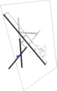
Runway info
Runway 13 / 31  | ||
| length | 1888m (6194ft) | |
| bearing | 135° / 315° | |
| width | 30m (98ft) | |
| surface | asphalt | |
| Runway 17 / 35 | ||
| length | 826m (2710ft) | |
| bearing | 180° / 0° | |
| width | 30m (98ft) | |
| surface | grass | |
| Runway 03 / 21 | ||
| length | 799m (2621ft) | |
| bearing | 54° / 234° | |
| width | 30m (98ft) | |
| surface | grass | |
Nearby beacons
| code | identifier | dist | bearing | frequency |
|---|---|---|---|---|
| POY | POWELL NDB | 0.3 | 93° | 344 |
| HCY | COWLEY NDB | 15.1 | 82° | 257 |
| COD | CODY VOR/DME | 16.5 | 215° | 111.80 |
| GEY | GREYBULL NDB | 37.1 | 117° | 275 |
| BIL | BILLINGS VORTAC | 56.9 | 10° | 114.50 |
| RLY | WORLAND VOR/DME | 65.1 | 137° | 114.80 |
Instrument approach procedures
| runway | airway (heading) | route (dist, bearing) |
|---|---|---|
| RW13 | BIL (190°) | BIL REDLO (40mi, 222°) 8000ft DUPZE (14mi, 141°) 8000ft |
| RW13 | COD (35°) | COD DUPZE (25mi, 1°) 8000ft DUPZE (turn) 8000ft |
| RNAV | DUPZE 8000ft AKEVY (6mi, 135°) 6900ft GEVEC (3mi, 135°) 5940ft KPOY (3mi, 137°) 5035ft (6198mi, 112°) 5296ft EVZOB (6197mi, 292°) CRANY (37mi, 149°) 8500ft CRANY (turn) | |
| RW31 | CRANY (327°) | CRANY YACSE (28mi, 334°) 7900ft |
| RW31 | NICQE (360°) | NICQE YACSE (24mi, 23°) 7900ft |
| RNAV | YACSE 7900ft ZABIG (6mi, 315°) 7000ft KPOY (6mi, 314°) 5149ft (6198mi, 112°) 5346ft WODNI (6200mi, 292°) EDDAR (28mi, 16°) 9500ft EDDAR (turn) |
Disclaimer
The information on this website is not for real aviation. Use this data with the X-Plane flight simulator only! Data taken with kind consent from X-Plane 12 source code and data files. Content is subject to change without notice.