Barre/montpelier - Edward F Knapp State
Airport details
| Country | United States of America |
| State | Vermont |
| Region | K6 |
| Airspace | Boston Ctr |
| Municipality | Berlin |
| Elevation | 1165ft (355m) |
| Timezone | GMT -5 |
| Coordinates | 44.20349, -72.56210 |
| Magnetic var | |
| Type | land |
| Available since | X-Plane v10.40 |
| ICAO code | KMPV |
| IATA code | MPV |
| FAA code | MPV |
Communication
| Edward F Knapp State ASOS | 132.675 |
| Edward F Knapp State CTAF/UNICOM | 122.800 |
Approach frequencies
| ILS-cat-I | RW17 | 108.7 | 18.00mi |
| 3° GS | RW17 | 108.7 | 18.00mi |
Nearby Points of Interest:
Chauncey B. Leonard House
-Woodbury Graded School
-Joshua Twing Gristmill
-Union Co-operative Store Bakery
-Beck and Beck Granite Shed
-E. L. Smith Roundhouse Granite Shed
-Scampini Block
-Barre City Hall and Opera House
-Aldrich Public Library
-National Clothespin Factory
-College Hall
-Athenwood and the Thomas W. Wood Studio
-Parley Davis House
-Mayo Building
-Central Vermont Railway Depot
-Nichols House
-Old Red Mill
-Allenwood Farm
-Gale-Bancroft House
-Harlie Whitcomb Farm
-Middlesex–Winooski River Bridge
-Mad River Valley Rural Historic District
-Waitsfield Common Historic District
-Worcester Town Hall
-Marvin Newton House
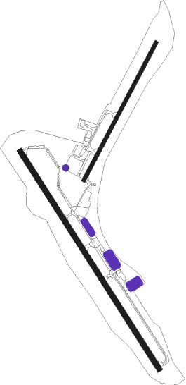
Runway info
Runway 17 / 35  | ||
| length | 1524m (5000ft) | |
| bearing | 143° / 323° | |
| width | 30m (100ft) | |
| surface | asphalt | |
| displ threshold | 0m (0ft) / 154m (505ft) | |
| Runway 5 / 23 | ||
| length | 915m (3002ft) | |
| bearing | 41° / 221° | |
| width | 23m (75ft) | |
| surface | asphalt | |
Nearby beacons
| code | identifier | dist | bearing | frequency |
|---|---|---|---|---|
| MPV | MONTPELIER VOR/DME | 8.5 | 136° | 116.90 |
| BTV | BURLINGTON VOR/DME | 29 | 287° | 117.50 |
| BJA | BURLINGTON TACAN | 30.3 | 295° | 112.40 |
| DYO | SMUTO (RUTLAND) NDB | 34.3 | 218° | 221 |
| LAH | HANOVER (LEBANON) NDB | 34.3 | 142° | 276 |
| LEB | DME | 34.8 | 147° | 113.70 |
| BT | HERRO (BURLINGTON) NDB | 35.5 | 296° | 382 |
| GMA | MAHN (WHITEFIELD) NDB | 38.8 | 80° | 386 |
| RUT | DME | 43.9 | 210° | 111 |
| CNH | CLAREMONT NDB | 50.7 | 167° | 233 |
| CON | CONCORD VOR/DME | 72.9 | 135° | 112.90 |
Instrument approach procedures
| runway | airway (heading) | route (dist, bearing) |
|---|---|---|
| RW17 | BTV (107°) | BTV EWVAP (14mi, 53°) 6000ft OCIVA (6mi, 91°) 6000ft REGGI (6mi, 151°) 6000ft |
| RW17 | MPV (316°) | MPV REGGI (27mi, 320°) 6000ft REGGI (turn) 6000ft |
| RW17 | PLOTT (226°) | PLOTT HUSAV (20mi, 268°) 6000ft REGGI (6mi, 231°) 6000ft |
| RW17 | VUYUD (126°) | VUYUD REGGI (6mi, 84°) 6000ft |
| RNAV | REGGI 6000ft JIPDO (4mi, 143°) 5000ft ZAXOL (4mi, 143°) 4200ft WANUX (4mi, 143°) 2980ft KMPV (6mi, 142°) 1142ft (4660mi, 121°) 1700ft MPV (4654mi, 301°) 5200ft MPV (turn) 5200ft | |
| RW35 | BTV (107°) | BTV XIMKY (42mi, 118°) 5600ft XIMKY (turn) 5000ft |
| RW35 | MUDDI (33°) | MUDDI WATKA (17mi, 61°) 5600ft XIMKY (7mi, 69°) 5000ft |
| RNAV | XIMKY 5000ft UFERA (8mi, 323°) 4000ft ZAXER (4mi, 323°) 2560ft KMPV (4mi, 325°) 1213ft (4660mi, 121°) 2400ft MPV (4654mi, 301°) 5100ft MPV (turn) 5100ft |
Disclaimer
The information on this website is not for real aviation. Use this data with the X-Plane flight simulator only! Data taken with kind consent from X-Plane 12 source code and data files. Content is subject to change without notice.