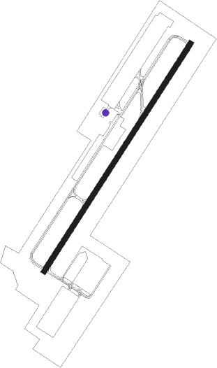
Doylestown
Airport details
| Country | United States of America |
| State | Pennsylvania |
| Region | K6 |
| Airspace | New York Ctr |
| Municipality | Buckingham Township |
| Elevation | 394ft (120m) |
| Timezone | GMT -5 |
| Coordinates | 40.33305, -75.12234 |
| Magnetic var | |
| Type | land |
| Available since | X-Plane v10.40 |
| ICAO code | KDYL |
| IATA code | DYL |
| FAA code | DYL |
Communication
| Doylestown ASOS | 118.875 |
| Doylestown CTAF/UNICOM | 122.975 |
| Doylestown PHILADELPHIA Approach | 123.800 |
| Doylestown PHILADELPHIA Departure | 123.800 |
Nearby Points of Interest:
Moravian Pottery and Tile Works
-Fonthill, Mercer Museum and Moravian Pottery and Tile Works
-James-Lorah House
-Pugh Dungan House
-The Fountain House
-Oscar Hammerstein II Farm
-Doylestown Historic District
-Shaw Historic District
-Spring Valley Historic District
-Mechanicsville Village Historic District
-Tabor Home for Needy and Destitute Children
-Fordhook Farm
-Gardenville-North Branch Rural Historic District
-Thomas and Lydia Gilbert Farm
-Longland
-Holicong Village Historic District
-Forest Grove Historic District
-Fretz Farm
-Buckingham Friends Meeting House
-Morgan James Homestead
-Bridge in Solebury Township
-Carversville Historic District
-Green Hills Farm
-Chalfont Historic District
-Gen. John Lacey Homestead
Nearby beacons
| code | identifier | dist | bearing | frequency |
|---|---|---|---|---|
| ARD | YARDLEY VOR/DME | 10.9 | 110° | 108.20 |
| ING | AMBLER NDB | 14.5 | 218° | 275 |
| PTW | POTTSTOWN VORTAC | 21.1 | 256° | 116.50 |
| SBJ | SOLBERG VOR/DME | 22.9 | 57° | 112.90 |
| FJC | ALLENTOWN VORTAC | 28 | 320° | 117.50 |
| ETX | EAST TEXAS VOR/DME | 29.6 | 294° | 110.20 |
| RBV | ROBBINSVILLE VORTAC | 29.7 | 102° | 113.80 |
| GXU | MC GUIRE (WRIGHTSTOWN) VORTAC | 30.9 | 122° | 110.60 |
| BWZ | BROADWAY (SCHOOLEY'S MT) VOR/DME | 31.1 | 33° | 114.20 |
| MXE | MODENA VORTAC | 35.4 | 233° | 113.20 |
| NEL | LAKEHURST TACAN | 39.5 | 111° | 111.80 |
| CAT | CHATHAM NDB | 39.9 | 60° | 254 |
| NEL | LAKEHURST NDB | 40 | 110° | 396 |
| STW | STILLWATER VOR/DME | 41.4 | 21° | 109.60 |
| OOD | WOODSTOWN VORTAC | 42.6 | 195° | 112.80 |
| COL | COLTS NECK VOR/DME | 44 | 91° | 115.40 |
| CYN | COYLE VORTAC | 44.3 | 127° | 113.40 |
| DQO | DUPONT (WILMINGTON) VORTAC | 45.2 | 217° | 114 |
| VCN | CEDAR LAKE (MILLVILLE) VOR/DME | 48.2 | 169° | 115.20 |
| MM | MOREE (MORRISTOWN) NDB | 48.6 | 55° | 392 |
| IL | HADIN (WILMINGTON) NDB | 50.5 | 213° | 248 |
| SAX | SPARTA VORTAC | 51.5 | 38° | 115.70 |
| TE | TORBY (TETERBORO) NDB | 53.2 | 65° | 214 |
| RNB | RAINBOW (MILLVILLE) NDB | 54.9 | 181° | 363 |
| ACY | ATLANTIC CITY VORTAC | 58.3 | 148° | 108.60 |
| LVZ | WILKES-BARRE VORTAC | 62 | 329° | 111.60 |
Instrument approach procedures
| runway | airway (heading) | route (dist, bearing) |
|---|---|---|
| RW05 | AWISA (45°) | AWISA 3000ft |
| RNAV | AWISA 3000ft WOKUS (7mi, 45°) 2000ft KDYL (5mi, 45°) 432ft (4727mi, 118°) 800ft AWISA (4733mi, 298°) 3000ft AWISA (turn) | |
| RW23 | DIRPE (223°) | DIRPE 3000ft |
| RNAV | DIRPE 3000ft ZURDA (5mi, 220°) 2000ft KDYL (5mi, 225°) 434ft WOKUS (5mi, 225°) AWISA (7mi, 225°) 3000ft AWISA (turn) |
Disclaimer
The information on this website is not for real aviation. Use this data with the X-Plane flight simulator only! Data taken with kind consent from X-Plane 12 source code and data files. Content is subject to change without notice.