Lincoln - Logan County
Airport details
| Country | United States of America |
| State | Illinois |
| Region | K5 |
| Airspace | Chicago Ctr |
| Municipality | Logan County |
| Elevation | 594ft (181m) |
| Timezone | GMT -6 |
| Coordinates | 40.15870, -89.33503 |
| Magnetic var | |
| Type | land |
| Available since | X-Plane v10.40 |
| ICAO code | KAAA |
| IATA code | n/a |
| FAA code | AAA |
Communication
| Logan County AWOS 3 | 118.775 |
| Logan County CTAF/UNICOM | 122.800 |
| Logan County SPRINGFIELD Approach/Departure | 126.150 |
Nearby Points of Interest:
University Hall
-Hoblit House
-Lincoln Public Library
-Stephan A. Foley House
-Atlanta Public Library
-Downey Building
-Theodore H. O. Mattfeldt House
-Robert Buckles Barn
-Price-Prather House
-Ayer Public Library
-Magill House
-Waltmire Bridge
-Power Farmstead
-Cornelius Flagg Farmstead
-Col. Matthew Rogers Building
-Illinois Traction System Mackinaw Depot
-Allentown Union Hall
-Bloomington Central Business District
-State Farm Downtown Building
-George M. Brinkerhoff House
-Roosevelt Junior High School
-East Grove Street District
-Ruben M. Benjamin House
-Stevenson House
-Robert Greenlee House
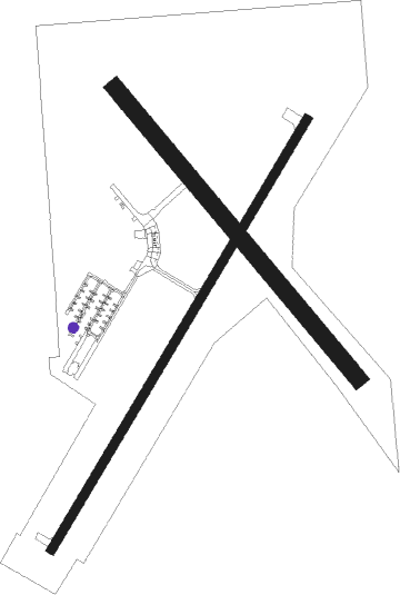
Runway info
Runway 3 / 21  | ||
| length | 1220m (4003ft) | |
| bearing | 43° / 223° | |
| width | 21m (70ft) | |
| surface | asphalt | |
| blast zone | 0m (0ft) / 67m (220ft) | |
| Runway 14 / 32 | ||
| length | 921m (3022ft) | |
| bearing | 137° / 317° | |
| width | 41m (135ft) | |
| surface | grass | |
| displ threshold | 94m (308ft) / 0m (0ft) | |
Nearby beacons
| code | identifier | dist | bearing | frequency |
|---|---|---|---|---|
| AAA | ABRAHAM (LINCOLN) NDB | 0.1 | 295° | 329 |
| LQ | LICOL (SPRINGFIELD) NDB | 19.2 | 227° | 375 |
| CJ | CALDE (SPRINGFIELD) NDB | 24.8 | 215° | 240 |
| SPI | SPINNER (SPRINGFIELD) VORTAC | 24.8 | 227° | 112.70 |
| BMI | BLOOMINGTON VOR/DME | 26.7 | 51° | 108.20 |
| DE | ELWIN (DECATUR) NDB | 28.2 | 134° | 275 |
| PI | TUNGG (PEORIA) NDB | 29.3 | 330° | 356 |
| SP | HUSKK (SPRINGFIELD) NDB | 30.3 | 228° | 382 |
| LH | EGROW (BLOOMINGTON-NORMAL) NDB | 32 | 49° | 334 |
| AXC | ADDERS VORTAC | 33.5 | 131° | 117.20 |
| PIA | PEORIA VORTAC | 37.6 | 319° | 115.20 |
| IJX | DME | 47.5 | 247° | 108.60 |
| PNT | PONTIAC VOR/DME | 48.3 | 42° | 109.60 |
| SYZ | SHELBYVILLE NDB | 50.5 | 147° | 365 |
| DTG | DWIGHT NDB | 71.4 | 43° | 344 |
Instrument approach procedures
| runway | airway (heading) | route (dist, bearing) |
|---|---|---|
| RW03 | GROWL (79°) | GROWL TENCU (12mi, 111°) 2500ft |
| RW03 | LATHA (342°) | LATHA TENCU (18mi, 308°) 2500ft |
| RW03 | OBACO (19°) | OBACO TENCU (4mi, 298°) 2500ft |
| RW03 | SPI (47°) | SPI TENCU (13mi, 51°) 2500ft |
| RW03 | TENCU (43°) | TENCU 2500ft |
| RNAV | TENCU 2500ft RUCON (6mi, 43°) 2300ft KAAA (6mi, 43°) 629ft (5375mi, 114°) 997ft PIMKE (5368mi, 294°) 2700ft PIMKE (turn) | |
| RW21 | MCLEN (219°) | MCLEN PIMKE (6mi, 210°) 2700ft |
| RW21 | PIMKE (223°) | PIMKE 2700ft |
| RNAV | PIMKE 2700ft ZOPOP (6mi, 223°) 2300ft KAAA (5mi, 223°) 630ft (5375mi, 114°) 997ft PIMKE (5368mi, 294°) 2700ft PIMKE (turn) |
Disclaimer
The information on this website is not for real aviation. Use this data with the X-Plane flight simulator only! Data taken with kind consent from X-Plane 12 source code and data files. Content is subject to change without notice.