Diego Garcia - Diego Garcia Nsf
Airport details
| Country | British Indian Ocean Territory |
| State | [Other] |
| Region | FJ |
| Airspace | Mauritius Ctr |
| Municipality | British Indian Ocean Territory |
| Elevation | 7ft (2m) |
| Timezone | GMT +6 |
| Coordinates | -7.29762, 72.40028 |
| Magnetic var | |
| Type | land |
| Available since | X-Plane v10.40 |
| ICAO code | FJDG |
| IATA code | NKW |
| FAA code | n/a |
Communication
| DIEGO GARCIA NSF ATIS | 282.000 |
| DIEGO GARCIA NSF Tower | 126.200 |
| DIEGO GARCIA NSF Ground Control | 118.400 |
| DIEGO GARCIA NSF Approach | 134.100 |
Approach frequencies
| ILS-cat-I | RW31 | 109.3 | 18.00mi |
| 3° GS | RW31 | 109.3 | 18.00mi |
Runway info
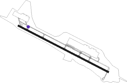
| Runway 13 / 31 | ||
| length | 3664m (12021ft) | |
| bearing | 122° / 302° | |
| width | 61m (200ft) | |
| surface | concrete | |
| blast zone | 255m (837ft) / 255m (837ft) | |
Nearby beacons
| code | identifier | dist | bearing | frequency |
|---|---|---|---|---|
| NDG | DIEGO GARCIA NDB | 1 | 288° | 300 |
| NKW | DIEGO GARCIA VORTAC | 1.3 | 149° | 112 |
Instrument approach procedures
| runway | airway (heading) | route (dist, bearing) |
|---|---|---|
| RW13 | FRRED (81°) | FRRED 3000ft PAXEE (9mi, 32°) 3000ft |
| RW13 | ZOTUP (160°) | ZOTUP 3000ft PAXEE (9mi, 211°) 3000ft |
| RNAV | PAXEE 3000ft PEBLS (6mi, 122°) 1800ft FJDG (5mi, 116°) 64ft (4357mi, 276°) 413ft HUBOL (4368mi, 96°) 3000ft HUBOL (turn) 4000ft | |
| RW31 | SAKLE (338°) | SAKLE 3000ft HUBOL (9mi, 32°) 3000ft |
| RW31 | TIDOG (268°) | TIDOG 3000ft HUBOL (9mi, 212°) 3000ft |
| RNAV | HUBOL 3000ft NIKBE (6mi, 302°) 1600ft FJDG (7mi, 305°) 72ft (4357mi, 276°) 380ft PAXEE (4347mi, 96°) 3000ft PAXEE (turn) 4000ft |
Disclaimer
The information on this website is not for real aviation. Use this data with the X-Plane flight simulator only! Data taken with kind consent from X-Plane 12 source code and data files. Content is subject to change without notice.