Retford - Retford Gamston
Airport details
| Country | United Kingdom |
| State | England |
| Region | EG |
| Airspace | London Ctr |
| Municipality | Bassetlaw |
| Elevation | 88ft (27m) |
| Timezone | GMT +0 |
| Coordinates | 53.28056, -0.95139 |
| Magnetic var | |
| Type | land |
| Available since | X-Plane v10.40 |
| ICAO code | EGNE |
| IATA code | n/a |
| FAA code | n/a |
Communication
| Retford Gamston Gamston Radio | 130.475 |
Nearby Points of Interest:
Milton Mausoleum
-Town Hall
-Holy Trinity Hospital (Almshouses)
-Sloswicke's Hospital
-Boughton Pumping Station
-St Giles' Church, Darlton
-Whimpton Moor medieval village and moated site
-St Oswald's Church, Dunham-on-Trent
-Worksop Town Hall
-St Gregory's Church, Fledborough
-Hodsock Priory
-Worksop Manor
-Blyth Priory
-St Nicholas' Church, Littleborough
-St Martin of Tours' Church, Saundby
-Cuckney Castle
-Serlby Hall
-Kettlethorpe Hall
-Holy Trinity Church, Everton
-Shireoaks Hall
-Stow Park railway station
-Lindrick Golf Club
-Gainsborough Bridge
-Sandbeck Park
-St John's Church, Throapham
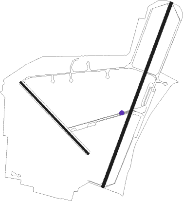
Runway info
Runway 03 / 21  | ||
| length | 1809m (5935ft) | |
| bearing | 38° / 218° | |
| width | 30m (98ft) | |
| surface | asphalt | |
| displ threshold | 294m (965ft) / 316m (1037ft) | |
| Runway 15 / 33 | ||
| length | 909m (2982ft) | |
| bearing | 126° / 306° | |
| width | 18m (59ft) | |
| surface | asphalt | |
| displ threshold | 57m (187ft) / 52m (171ft) | |
Nearby beacons
| code | identifier | dist | bearing | frequency |
|---|---|---|---|---|
| GAM | GAMSTON VOR/DME | 0.1 | 78° | 112.80 |
| FNY | DONCASTER SHEFFIELD NDB | 11.8 | 345° | 338 |
| WAD | WADDINGTON TACAN | 16.7 | 105° | 117.10 |
| CWL | CRANWELL NDB | 22.5 | 119° | 423 |
| CWZ | CRANWELL TACAN | 22.5 | 118° | 117.40 |
| KIM | HUMBERSIDE NDB | 27.7 | 64° | 365 |
| EME | EAST MIDLANDS NDB | 28.2 | 209° | 353 |
| TNT | TRENT VOR/DME | 29.2 | 252° | 115.70 |
| CGY | CONINGSBY TACAN | 30.3 | 104° | 111.10 |
| SBL | SHERBURN-IN-ELMET NDB | 31.9 | 333° | 323 |
| EMW | EAST MIDLANDS NDB | 32.6 | 228° | 393 |
| OTR | OTTRINGHAM VOR/DME | 39.3 | 64° | 113.90 |
| LE | LEICESTER NDB | 40.6 | 187° | 383 |
| TNL | TATENHILL NDB | 40.6 | 240° | 327 |
| LBA | LEEDS BRADFORD NDB | 43.1 | 310° | 402 |
| WIT | WITTERING TACAN | 43.5 | 146° | 117.60 |
| BHX | BIRMINGHAM NDB | 57.4 | 224° | 406 |
| HON | HONILEY VOR/DME | 61.2 | 218° | 113.65 |
| MAM | MARHAM TACAN | 66.6 | 113° | 108.70 |
Disclaimer
The information on this website is not for real aviation. Use this data with the X-Plane flight simulator only! Data taken with kind consent from X-Plane 12 source code and data files. Content is subject to change without notice.