Upminster - Damyns Hall
Airport details
| Country | United Kingdom |
| State | England |
| Region | EG |
| Airspace | London Ctr |
| Municipality | London |
| Elevation | 50ft (15m) |
| Timezone | GMT +0 |
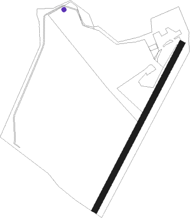
| Coordinates | 51.52950, 0.24550 |
| Magnetic var | |
| Type | land |
| Available since | X-Plane v10.40 |
| ICAO code | EGML |
| IATA code | n/a |
| FAA code | n/a |
Communication
| Damyns Hall AIR_GROUND Hornchurch Radio | 119.550 |
Nearby Points of Interest:
Cranham Hall
-Langtons
-Hare Hall
-Grays Thurrock Chalk Pit
-Dagenham Civic Centre
-Havering Town Hall
-State Cinema
-Ingress Abbey
-The Embassy Cinema
-Thorndon Park Chapel
-Thorndon Park
-Stone Castle
-Thorndon Hall
-Bower House
-South Weald Camp
-The Kings Head
-the kings head
-Bentley Priory
-St James' Church, West Tilbury
-Tilbury Riverside railway station
-Plumstead Common Windmill
-Shenfield Hall
-Gravesend town pier
-Dr Barnardo's Memorial
-Gravesend Town Hall
Nearby beacons
| code | identifier | dist | bearing | frequency |
|---|---|---|---|---|
| LCY | LONDON CITY NDB | 6.8 | 262° | 322 |
| LAM | LAMBOURNE VOR/DME | 7.8 | 321° | 115.60 |
| BIG | BIGGIN VOR/DME | 14.3 | 227° | 115.10 |
| SND | SOUTHEND NDB | 17.2 | 84° | 362 |
| BPK | BROOKMANS PARK VOR/DME | 18.6 | 302° | 117.50 |
| DET | DETLING VOR/DME | 18.8 | 123° | 117.30 |
| EPM | EPSOM NDB | 26.3 | 251° | 316 |
| LON | LONDON VOR/DME | 26.7 | 267° | 113.60 |
| HLS | DME | 27.1 | 133° | 115.95 |
| LSH | HEADCORN (LASHENDEN) NDB | 27.1 | 133° | 340 |
| BKY | BARKWAY VOR/DME | 28.4 | 338° | 116.25 |
| LUT | LUTON NDB | 28.7 | 306° | 345 |
| CHT | CHILTERN NDB | 29 | 277° | 277 |
| OCK | OCKHAM VOR/DME | 29.2 | 252° | 115.30 |
| MAY | MAYFIELD VOR/DME | 31.1 | 194° | 117.90 |
| BNN | BOVINGDON VOR/DME | 31.9 | 284° | 113.75 |
| BUR | BURNHAM NDB | 34.4 | 269° | 421 |
| CLN | CLACTON VOR/DME | 38.6 | 71° | 114.55 |
| LYD | LYDD VOR/DME | 39.7 | 130° | 114.05 |
| CAM | CAMBRIDGE NDB | 40.9 | 355° | 332 |
| HEN | HENTON NDB | 41 | 283° | 433 |
| WOD | WOODLEY NDB | 42.2 | 266° | 352 |
| BLC | DME | 42.6 | 259° | 116.20 |
| BLK | BLACKBUSHE NDB | 42.6 | 259° | 328 |
| LZD | LYDD NDB | 43 | 129° | 397 |
| MID | MIDHURST VOR/DME | 43.4 | 241° | 114 |
| WTZ | WATTISHAM TACAN | 43.9 | 50° | 109.30 |
| SHM | SHOREHAM NDB | 46.3 | 218° | 332 |
| SRH | DME-ILS | 46.3 | 218° | 109.95 |
| SFD | SEAFORD VOR/DME | 46.4 | 189° | 117 |
| CIT | CRANFIELD NDB | 46.7 | 307° | 850 |
| ODH | ODIHAM TACAN | 48.1 | 256° | 109.60 |
| WCO | WESTCOTT NDB | 48.9 | 285° | 335 |
| BSO | BENSON TACAN | 50.4 | 274° | 110 |
| MLD | MILDENHALL TACAN | 50.8 | 16° | 115.90 |
| LKH | LAKENHEATH TACAN | 53.8 | 19° | 110.20 |
| CPT | COMPTON VOR/DME | 54.8 | 269° | 114.35 |
| GWC | GOODWOOD VOR/DME | 55.3 | 236° | 114.75 |
| DTY | DAVENTRY VOR/DME | 63.7 | 296° | 116.40 |
Disclaimer
The information on this website is not for real aviation. Use this data with the X-Plane flight simulator only! Data taken with kind consent from X-Plane 12 source code and data files. Content is subject to change without notice.