Airport details
| Country | United Kingdom |
| State | Scotland |
| Region | EG |
| Airspace | Scottish Ctr |
| Municipality | Argyll and Bute |
| Elevation | 39ft (12m) |
| Timezone | GMT +0 |
| Coordinates | 56.05750, -6.24306 |
| Magnetic var | |
| Type | land |
| Available since | X-Plane v10.40 |
| ICAO code | EGEY |
| IATA code | CSA |
| FAA code | n/a |
Communication
No airport communication available for EGEY
Nearby Points of Interest:
Dùn Galláin
- Fingal's Limpet Hammers,standing stones,Lower Kilchattan, Colonsay
- Dùn Cholla
- Ardnave House
- Piermasters Shipping Office (D. Macbranes) House And Post Office Port Askaig
- Post Office And Shop, Houses, Port Askaig, Islay
- Jetty, Port Askaig, Islay
- Dunlossit House, Port Askaig, Islay
- Islay, Craigens
- Emeraconart, Islay
- Islay, Redhouses, Woollen Mill
- Islay Home Farm
- Islay House
- Islay, Islay House, East Tower
- Islay, Bridgend, Sornbank
- Islay, Bridgend, River Sorn, Bridge
- Shop And House, Post Office, Bridgend, Islay
- Eileach-an-Naoimh, monastery, Garvellachs
- Kilchoman House
- Bowmore Town Hall
- Garvellachs
- Islay, Kilchiaran, Kilchiaran Farmhouse
- Islay, Kilchiaran, Kilchiaran Steading
- Ruadh Sgeir Lighthouse
- 33–41 Main Street, Port Charlotte
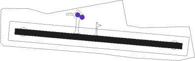
Runway info
| Runway 10 / 28 |
|
| | length | 500m (1640ft) |
| | bearing | 95° / 275° |
| | width | 18m (59ft) |
| | surface | asphalt |
Airport layout - parking location Apron
Parking locations