Garvagh - Movenis
Airport details
| Country | United Kingdom |
| State | Northern Ireland |
| Region | |
| Airspace | Scottish Ctr |
| Municipality | County Londonderry |
| Elevation | 180ft (55m) |
| Timezone | GMT +0 |
| Coordinates | 54.98683, -6.64729 |
| Magnetic var | |
| Type | land |
| Available since | X-Plane v10.40 |
| ICAO code | EG71 |
| IATA code | n/a |
| FAA code | n/a |
Communication
Nearby Points of Interest:
Town Hall The Diamond Coleraine Co.londonderry
-Binevenagh
-Causeway Coast and Glens
-Sperrins
-Guildhall, Derry
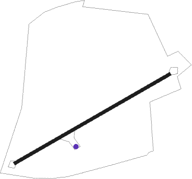
Runway info
| Runway 07 / 25 | ||
| length | 420m (1378ft) | |
| bearing | 75° / 255° | |
| width | 7m (23ft) | |
| surface | asphalt | |
Nearby beacons
| code | identifier | dist | bearing | frequency |
|---|---|---|---|---|
| EGT | LONDONDERRY NDB | 17.8 | 277° | 328 |
| BEL | BELFAST VOR/DME | 24.3 | 128° | 117.20 |
| OY | BELFAST/ALDERGROVE NDB | 26.2 | 118° | 332 |
| HB | BELFAST CITY NDB | 34.6 | 115° | 420 |
| CBL | CAMPBELTOWN NDB | 42.5 | 65° | 380 |
| MAC | MACHRIHANISH VOR/DME | 43.3 | 66° | 116 |
| ISY | DME-ILS | 43.9 | 30° | 109.95 |
| LAY | ISLAY NDB | 43.9 | 30° | 395 |
Disclaimer
The information on this website is not for real aviation. Use this data with the X-Plane flight simulator only! Data taken with kind consent from X-Plane 12 source code and data files. Content is subject to change without notice.