Saint Ghislain - St. Ghislain
Airport details
| Country | Belgium |
| State | Hainaut |
| Region | EB |
| Airspace | Brussels Ctr |
| Municipality | Saint-Ghislain |
| Elevation | 75ft (23m) |
| Timezone | GMT +1 |
| Coordinates | 50.45750, 3.82028 |
| Magnetic var | |
| Type | land |
| Available since | X-Plane v10.40 |
| ICAO code | EBSG |
| IATA code | n/a |
| FAA code | n/a |
Communication
Nearby Points of Interest:
Major Mining Sites of Wallonia
-Mausoleum of the Lords of Boussu
-Underground quarries of the Malogne
-Mer de Sable
-Valenciennes Tower
-Crespin Abbey
-Basilica of Our Lady of Bon-Secours
-tour sarrazine
-Fontaine des Brigittins
-Bagacum
-Feignies
-château de la Catoire
-northern French coal mining region
-lifts on the old Canal du Centre
-Tour Burbant
-Le Rœulx Castle
-Modern Hôtel
-grande carrière Wincqz
-Chapître des Chanoinesses de Maubeuge
-Hôtel de ville de Valenciennes
-Collège des Jésuites de Valenciennes
-Abbaye d'Haumont
-église de Saint-Vaast
-Le Blanc Moulin
-city walls of Binche
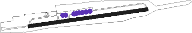
Runway info
| Runway 09 / 27 | ||
| length | 696m (2283ft) | |
| bearing | 88° / 268° | |
| width | 22m (72ft) | |
| surface | asphalt | |
| displ threshold | 27m (89ft) / 29m (95ft) | |
Nearby beacons
| code | identifier | dist | bearing | frequency |
|---|---|---|---|---|
| CIV | CHIEVRES VORTAC | 7 | 6° | 113.20 |
| VS | VALENCIENNES NDB | 18.9 | 257° | 317 |
| GSY | GOSLY (CHARLEROI) VOR/DME | 23.7 | 90° | 115.70 |
| LL | LILLE NDB | 24.3 | 282° | 332 |
| ONC | CHARLEROI NDB | 28.1 | 88° | 323 |
| LEQ | LILLE LESQUIN VOR/DME | 28.6 | 278° | 109 |
| CMB | CAMBRAI EPINOY VOR/DME | 29 | 251° | 112.60 |
| AFI | AFFLIGEM VOR/DME | 29.6 | 35° | 114.90 |
| MAK | MACKEL NDB | 32.8 | 327° | 360 |
| OZ | BRUSSELS NATIONAL NDB | 33.1 | 60° | 314 |
| BFS | FLORENNES TACAN | 34.4 | 105° | 111.50 |
| HUL | HULDENBERG VOR/DME | 35.8 | 70° | 117.55 |
| BUB | BRUSSELS VOR/DME | 38.2 | 58° | 114.60 |
| HTB | BEAUVECHAIN NDB | 40.2 | 73° | 381 |
| BBE | BEAUVECHAIN TACAN | 40.3 | 72° | 116 |
| OB | BRUSSELS NDB | 41.1 | 60° | 293 |
| OP | BRUSSELS NATIONAL NDB | 41.2 | 58° | 402 |
| NIK | NICKY VOR/DME | 44.6 | 27° | 117.40 |
| ANT | ANTWERP (DEURNE) VOR/DME | 50.4 | 42° | 113.50 |
| ONW | ANTWERP NDB | 51.1 | 46° | 355 |
| ONO | OOSTENDE NDB | 55.1 | 313° | 399 |
| COA | COSTA VOR/DME | 56.3 | 332° | 110.05 |
| OO | OOSTENDE (OOSTENDE-BRUGGE) NDB | 56.6 | 309° | 375 |
| DD | OOSTENDE (OOSTENDE-BRUGGE) NDB | 57.9 | 307° | 352 |
| WDT | WOENSDRECHT TACAN | 62.6 | 28° | 115 |
Disclaimer
The information on this website is not for real aviation. Use this data with the X-Plane flight simulator only! Data taken with kind consent from X-Plane 12 source code and data files. Content is subject to change without notice.