Oran - Es Senia
Airport details
| Country | Algeria |
| State | Oran |
| Region | DA |
| Airspace | Algiers Ctr |
| Municipality | Es Senia |
| Elevation | 293ft (89m) |
| Timezone | GMT +1 |
| Coordinates | 35.62722, -0.61139 |
| Magnetic var | |
| Type | land |
| Available since | X-Plane v10.40 |
| ICAO code | DAOO |
| IATA code | ORN |
| FAA code | n/a |
Communication
| ES SENIA ORAN Tower | 118.100 |
| ES SENIA ORAN Tower | 119.700 |
| ES SENIA ORAN Approach | 121.100 |
| ES SENIA ORAN Approach | 128.200 |
Approach frequencies
| ILS-cat-II | RW25L | 109.9 | 18.00mi |
| ILS-cat-I | RW25R | 108.7 | 18.00mi |
| 3° GS | RW25L | 109.9 | 18.00mi |
| 3° GS | RW25R | 108.7 | 18.00mi |
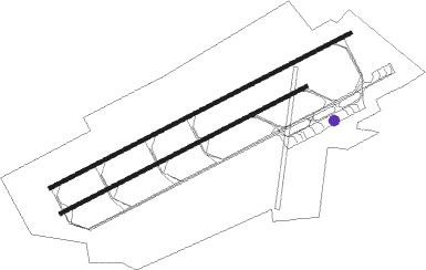
Runway info
Runway 07L / 25R  | ||
| length | 3690m (12106ft) | |
| bearing | 71° / 251° | |
| width | 45m (148ft) | |
| surface | asphalt | |
| displ threshold | 0m (0ft) / 154m (505ft) | |
| blast zone | 102m (335ft) / 0m (0ft) | |
| Runway 07R / 25L | ||
| length | 3011m (9879ft) | |
| bearing | 71° / 251° | |
| width | 45m (148ft) | |
| surface | asphalt | |
| blast zone | 85m (279ft) / 98m (322ft) | |
Nearby beacons
| code | identifier | dist | bearing | frequency |
|---|---|---|---|---|
| ORA | AHMED BENBELLA VOR/DME | 2.3 | 252° | 114 |
| OO | SIDI-CHAMI NDB | 4.1 | 71° | 265 |
| ON | BOUFATIS NDB | 13.7 | 71° | 415 |
| HMB | HAMMAM BOU HADJAR NDB | 23.6 | 234° | 432 |
| MOS | MOSTAGANEM VOR/DME | 39.9 | 70° | 112.20 |
| GRS | GHRISS VOR | 44.8 | 119° | 113.10 |
| GRS | GHRISS NDB | 45.1 | 118° | 424 |
| TLM | TLEMCEN VOR/DME | 55 | 234° | 116.50 |
Departure and arrival routes
| Transition altitude | 3248ft |
| SID end points | distance | outbound heading | |
|---|---|---|---|
| RW07 (ALL) | |||
| SID74 | 130mi | 46° | |
| SID71 | 105mi | 97° | |
| SID72 | 45mi | 119° | |
| SID73 | 55mi | 234° | |
| RW25 (ALL) | |||
| SID54 | 130mi | 46° | |
| SID51 | 105mi | 97° | |
| SID52 | 45mi | 119° | |
| SID53 | 55mi | 234° | |
Disclaimer
The information on this website is not for real aviation. Use this data with the X-Plane flight simulator only! Data taken with kind consent from X-Plane 12 source code and data files. Content is subject to change without notice.