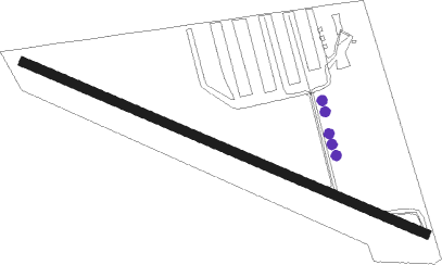
Palmyra - Reigle Field
Airport details
| Country | United States of America |
| State | Pennsylvania |
| Region | |
| Airspace | New York Ctr |
| Municipality | South Londonderry Township |
| Elevation | 487ft (148m) |
| Timezone | GMT -5 |
| Coordinates | 40.28798, -76.58006 |
| Magnetic var | |
| Type | land |
| Available since | X-Plane v10.40 |
| ICAO code | 58N |
| IATA code | n/a |
| FAA code | 58N |
Communication
| Reigle Field CTAF/UNICOM | 122.800 |
Nearby Points of Interest:
Dr. B. Stauffer House
-Landis Shoe Company Building
-Milton S. Hershey Mansion
-Derry Session House and Enclosure
-Bindnagles Evangelical Lutheran Church
-Annville Historic District
-Biever House
-Colebrook Iron Master's House
-John Todd House
-Enoch Matlack House
-Dr. William Henderson House
-Zion Lutheran Church and Graveyard
-Hummelstown Brownstone Company
-Gloninger Estate
-Union Canal
-Tabor Reformed Church
-Henry Smith Farm
-Salem Evangelical Lutheran Church
-Cornwall & Lebanon Railroad Station
-Reading Railroad Station
-Josiah Funck Mansion
-Kreider Shoe Manufacturing Company
-Conrad and Margaret Allerman House
-Simon Cameron House and Bank
-Charles and Joseph Raymond Houses
Nearby beacons
| code | identifier | dist | bearing | frequency |
|---|---|---|---|---|
| BZJ | BELLGROVE (INDIANTOWN GAP) NDB | 8.9 | 10° | 328 |
| MD | ENOLA (HARRISBURG) NDB | 14.9 | 263° | 204 |
| RAV | RAVINE VORTAC | 15.9 | 356° | 114.60 |
| LRP | LANCASTER VOR/DME | 16.6 | 120° | 117.30 |
| CX | LATLE (HARRISBURG) NDB | 20.5 | 256° | 219 |
| HAR | HARRISBURG VORTAC | 22.4 | 272° | 112.50 |
| SEG | SELINSGROVE VOR/DME | 33.2 | 329° | 110.40 |
| MIP | MILTON VORTAC | 44.3 | 353° | 109.20 |
| ETX | EAST TEXAS VOR/DME | 44.5 | 72° | 110.20 |
| MXE | MODENA VORTAC | 47.3 | 112° | 113.20 |
| EMI | WESTMINSTER VORTAC | 51 | 207° | 117.90 |
| DQO | DUPONT (WILMINGTON) VORTAC | 57.8 | 122° | 114 |
| MTN | MARTIN (BALTIMORE) TACAN | 58 | 170° | 134.10 |
| IL | HADIN (WILMINGTON) NDB | 61.4 | 126° | 248 |
| FDK | FREDERICK VOR | 64.1 | 222° | 109 |
| LVZ | WILKES-BARRE VORTAC | 71.6 | 42° | 111.60 |
Instrument approach procedures
| runway | airway (heading) | route (dist, bearing) |
|---|---|---|
| RWNVA | OSECU (345°) | OSECU 4000ft |
| RWNVA | WOTIB (322°) | WOTIB 4000ft OSECU (5mi, 278°) 4000ft |
| RWNVA | ZAKTU (12°) | ZAKTU 4000ft OSECU (5mi, 66°) 4000ft |
| RNAV | OSECU 4000ft HURPU (6mi, 347°) 2500ft JELIV (5mi, 347°) 1260ft (4792mi, 118°) 1680ft KUPPS (4787mi, 298°) 3000ft KUPPS (turn) |
Disclaimer
The information on this website is not for real aviation. Use this data with the X-Plane flight simulator only! Data taken with kind consent from X-Plane 12 source code and data files. Content is subject to change without notice.