Ulanqab Jining
Airport details
| Country | China |
| State | Inner Mongolia |
| Region | |
| Airspace | Beijing Ctr |
| Municipality | Ulanqab City |
| Elevation | 4611ft (1405m) |
| Timezone | GMT +8 |
| Coordinates | 41.12821, 113.08769 |
| Magnetic var | |
| Type | land |
| Available since | X-Plane v10.40 |
| ICAO code | ZBUC |
| IATA code | n/a |
| FAA code | n/a |
Communication
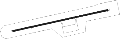
Runway info
| Runway 08 / 26 | ||
| length | 3192m (10472ft) | |
| bearing | 84° / 264° | |
| width | 46m (151ft) | |
| surface | concrete | |
Nearby beacons
| code | identifier | dist | bearing | frequency |
|---|---|---|---|---|
| TMR | TUMURTAI VOR/DME | 43 | 5° | 113.30 |
| SZ | LIANGCHENG NDB | 45.4 | 224° | 282 |
| TZH | TIANZHEN VOR/DME | 61.5 | 127° | 115.60 |
Disclaimer
The information on this website is not for real aviation. Use this data with the X-Plane flight simulator only! Data taken with kind consent from X-Plane 12 source code and data files. Content is subject to change without notice.