Zeeland - Ottawa Executive
Airport details
| Country | United States of America |
| State | Michigan |
| Region | K5 |
| Airspace | Chicago Ctr |
| Municipality | Zeeland Charter Township |
| Elevation | 740ft (226m) |
| Timezone | GMT -5 |
| Coordinates | 42.81725, -85.92809 |
| Magnetic var | |
| Type | land |
| Available since | X-Plane v10.40 |
| ICAO code | Z98 |
| IATA code | n/a |
| FAA code | Z98 |
Communication
| OTTAWA EXECUTIVE CTAF | 122.900 |
Nearby Points of Interest:
Hudsonville Christian School Building
-Old Wing Mission
-Holland Old City Hall and Fire Station
-Holland Downtown Historic District
-Isaac Cappon House
-Olive Township District No. 1 School
-Egbert H. Gold Estate
-Norton Mound Group
-Division Avenue–Plaster Creek Bridge
-Dorr E. Felt Mansion
-Saint Joseph Seminary
-Heartside Historic District
-Exhibitors Building
-Rood Building
-Goodspeed Brothers Building
-Peck Block
-Grand Rapids Savings Bank Building
-Michigan Trust Company Building
-President Gerald R. Ford, Jr. Boyhood Home
-Loraine Building
-Old Grand Rapids City Hall
-Woodbridge N. Ferris Building
-Grand Rapids, Grand Haven and Muskegon Railway Depot
-Berkey and Gay Furniture Company Factory
-Hacklander Site
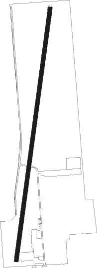
Runway info
| Runway 2 / 20 | ||
| length | 1160m (3806ft) | |
| bearing | 16° / 196° | |
| width | 18m (60ft) | |
| surface | asphalt | |
| displ threshold | 90m (295ft) / 58m (190ft) | |
Nearby beacons
| code | identifier | dist | bearing | frequency |
|---|---|---|---|---|
| VIO | VICTORY VOR/DME | 19 | 94° | 115.95 |
| MKG | MUSKEGON TACAN | 21.6 | 342° | 115.20 |
| PMM | PULLMAN VOR/DME | 22.4 | 207° | 112.10 |
| GR | KNOBS (GRAND RAPIDS) NDB | 24.6 | 82° | 263 |
| AZO | KALAMAZOO VOR/DME | 38.5 | 147° | 109 |
| ELX | KEELER VOR/DME | 41.3 | 196° | 116.60 |
| BT | BATOL (BATTLE CREEK) NDB | 42.7 | 121° | 272 |
| AZ | AUSTN (KALAMAZOO) NDB | 44.8 | 150° | 371 |
| HIC | WHITE CLOUD VOR/DME | 46.4 | 16° | 117.60 |
Disclaimer
The information on this website is not for real aviation. Use this data with the X-Plane flight simulator only! Data taken with kind consent from X-Plane 12 source code and data files. Content is subject to change without notice.