Elbow Lake - Elbow Lake Muni
Airport details
| Country | United States of America |
| State | Minnesota |
| Region | |
| Airspace | Minneapolis Ctr |
| Municipality | Elbow Lake |
| Elevation | 1205ft (367m) |
| Timezone | GMT -6 |
| Coordinates | 45.98844, -95.99613 |
| Magnetic var | |
| Type | land |
| Available since | X-Plane v10.40 |
| ICAO code | Y63 |
| IATA code | n/a |
| FAA code | Y63 |
Communication
| Elbow Lake Muni AWOS | 118.075 |
| Elbow Lake Muni CTAF | 122.900 |
Nearby Points of Interest:
Grant County Courthouse
-John W. Mason House
-Park Region Luther College
-Otter Tail County Courthouse
-Fergus Falls City Hall
-Edward J. Devitt U.S. Courthouse and Federal Building
-C.J. Wright House
-C.C. Clement House
-Fergus Falls Regional Treatment Center
-Tenney Fire Hall
-Stiklestad United Lutheran Church
-District No. 44 School
-Prospect House
-District No. 182 School
-Wheaton Depot
-Elizabeth Village Hall and Jail
-Morris Industrial School for Indians
-Alberta Teachers House
-Great Northern Passenger Depot
-Craigie Flour Mill Historical Marker
Runway info
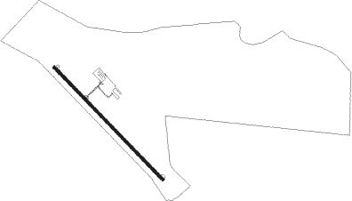
Runway 14 / 32  | ||
| length | 1037m (3402ft) | |
| bearing | 130° / 310° | |
| width | 18m (60ft) | |
| surface | asphalt | |
| Runway 11 / 29 | ||
| length | 1251m (4104ft) | |
| bearing | 103° / 283° | |
| width | 40m (130ft) | |
Nearby beacons
| code | identifier | dist | bearing | frequency |
|---|---|---|---|---|
| FF | HAMRE (FERGUS FALLS) NDB | 14.1 | 345° | 337 |
| FFM | FERGUS FALLS VOR/DME | 19.2 | 332° | 110.40 |
| MOX | MORRIS VOR/DME | 25.4 | 176° | 109.60 |
| AXN | ALEXANDRIA VOR/DME | 31.9 | 92° | 112.80 |
| DTL | DETROIT LAKES VOR/DME | 50.4 | 7° | 111.20 |
| FAR | FARGO VOR/DME | 58 | 312° | 116.20 |
| BDH | WILLMAR VOR/DME | 63.8 | 135° | 113.70 |
| PKD | RAPIDS DME | 66.7 | 45° | 110.60 |
Instrument approach procedures
| runway | airway (heading) | route (dist, bearing) |
|---|---|---|
| RW14 | HUFFY (130°) | HUFFY 3300ft |
| RNAV | HUFFY 3300ft GOBLR (6mi, 130°) 2800ft JORNI (2mi, 130°) 2000ft Y63 (2mi, 130°) 1243ft (5655mi, 116°) 1453ft TOWED (5649mi, 296°) 3300ft TOWED (turn) | |
| RW32 | TOWED (310°) | TOWED 3300ft |
| RNAV | TOWED 3300ft BLADE (6mi, 310°) 2800ft YABUT (2mi, 310°) 2060ft Y63 (3mi, 310°) 1241ft (5655mi, 116°) 1450ft HUFFY (5661mi, 296°) 3300ft HUFFY (turn) |
Disclaimer
The information on this website is not for real aviation. Use this data with the X-Plane flight simulator only! Data taken with kind consent from X-Plane 12 source code and data files. Content is subject to change without notice.