Mandan - Mandan Muni
Airport details
| Country | United States of America |
| State | North Dakota |
| Region | K3 |
| Airspace | Minneapolis Ctr |
| Municipality | Morton County |
| Elevation | 1942ft (592m) |
| Timezone | GMT -6 |
| Coordinates | 46.76797, -100.89436 |
| Magnetic var | |
| Type | land |
| Available since | X-Plane v10.40 |
| ICAO code | Y19 |
| IATA code | n/a |
| FAA code | Y19 |
Communication
| Mandan Muni CTAF/UNICOM | 122.800 |
| Mandan Muni Bismark Approach/Departure | 126.300 |
Nearby Points of Interest:
Liberty Memorial Bridge
-Bismarck Cathedral Area Historic District
-Dr. Albert M. and Evelyn M. Brandt House
-United States Post Office and Courthouse
-Northern Pacific Railway Depot
-Bismarck Tribune Building
-E. G. Patterson Building
-Burleigh County Courthouse
-Former North Dakota Executive Mansion
-Bismarck Civic Auditorium
-Fred and Gladys Grady House
-Towne–Williams House
-Our Lady of the Annunciation Chapel at Annunciation Priory
-Wilton, North Dakota Soo Line depot
-Hell Creek Formation
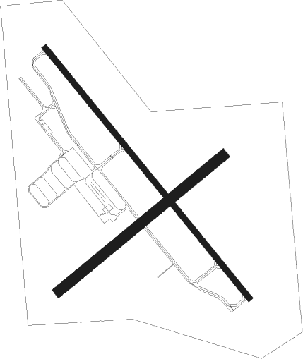
Runway info
Runway 13 / 31  | ||
| length | 1341m (4400ft) | |
| bearing | 135° / 315° | |
| width | 23m (75ft) | |
| surface | asphalt | |
| Runway 04 / 22 | ||
| length | 883m (2897ft) | |
| bearing | 64° / 244° | |
| width | 43m (140ft) | |
| surface | grass | |
Nearby beacons
| code | identifier | dist | bearing | frequency |
|---|---|---|---|---|
| BIS | BISMARCK VOR/DME | 9.4 | 92° | 116.50 |
| HZE | HAZEN NDB | 42.4 | 308° | 414 |
Instrument approach procedures
| runway | airway (heading) | route (dist, bearing) |
|---|---|---|
| RW13 | ILUPY (135°) | ILUPY 4000ft |
| RNAV | ILUPY 4000ft HOVLU (6mi, 135°) 3700ft Y19 (6mi, 135°) 1997ft (5852mi, 115°) 2192ft CEVEP (5850mi, 295°) 4700ft OHROR (12mi, 180°) 4700ft OHROR (turn) | |
| RW31 | UNHUF (315°) | UNHUF 4500ft |
| RNAV | UNHUF 4500ft KAKRE (6mi, 315°) 3800ft WATGI (3mi, 315°) 2780ft Y19 (3mi, 314°) 1988ft (5852mi, 115°) 2193ft ZUPJA (5854mi, 295°) 4600ft SAILM (13mi, 259°) 4600ft SAILM (turn) |
Disclaimer
The information on this website is not for real aviation. Use this data with the X-Plane flight simulator only! Data taken with kind consent from X-Plane 12 source code and data files. Content is subject to change without notice.