Peccioli - Pratello
Airport details
| Country | Italy |
| State | Tuscany |
| Region | |
| Airspace | Rome Ctr |
| Municipality | Peccioli |
| Elevation | 172ft (52m) |
| Timezone | GMT +1 |
| Coordinates | 43.55428, 10.75239 |
| Magnetic var | |
| Type | land |
| Available since | X-Plane v10.40 |
| ICAO code | XLI000D |
| IATA code | n/a |
| FAA code | n/a |
Communication
| Pratello Pratello Radio | 130.000 |
Nearby Points of Interest:
Museo delle icone russe
-Villa Baciocchi
-Palazzo Valli
-Villa Crastan
-Auditorium di San Martino
-Palazzo dei Vicari imperiali
-Oratorio del Loretino
-Sant'Andrea Apostolo
-San Biagio
-Saint Charles parish
-Volterra
-Chiesa della Vergine della Ferruzza
-San Michele Arcangelo
-Museo di arte sacra (Certaldo)
-Palazzo Ghibellino
-Palazzo Pretorio
-Historic Centre of San Gimignano
-Pisa Charterhouse
-Sacred Art Museum (Montespertoli)
-Palazzo Bombardieri
-Necropoli di Dometaia
-Biblioteca leonardiana
-Palazzo Vecchio de’ Medici
-Palazzo Campana
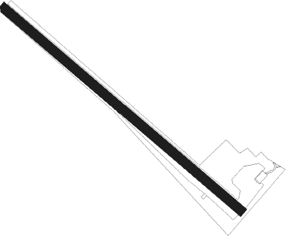
Runway info
| Runway 13 / 31 | ||
| length | 1001m (3284ft) | |
| bearing | 126° / 306° | |
| width | 30m (98ft) | |
| surface | grass | |
Nearby beacons
| code | identifier | dist | bearing | frequency |
|---|---|---|---|---|
| PIN | PISA TACAN | 17.1 | 297° | 108.30 |
| PIS | PISA VOR/DME | 17.3 | 289° | 112.10 |
| PIS | PISA NDB | 19.9 | 274° | 379 |
| PRT | PERETOLA (FLORENCE) VOR/DME | 24.7 | 60° | 112.50 |
| SAZ | SARZANA TACAN | 47.1 | 303° | 111.10 |
| GRO | GROSSETO VORTAC | 49.7 | 158° | 109.85 |
| ELB | ELBA VORTAC | 51.8 | 203° | 114.70 |
| BOA | BOLOGNA VOR/DME | 63.4 | 29° | 117.10 |
Disclaimer
The information on this website is not for real aviation. Use this data with the X-Plane flight simulator only! Data taken with kind consent from X-Plane 12 source code and data files. Content is subject to change without notice.