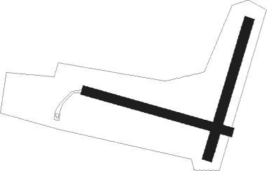
Veauce
Airport details
| Country | France |
| State | Auvergne-Rhône-Alpes |
| Region | LF |
| Airspace | Marseille Ctr |
| Municipality | Veauce |
| Elevation | 1568ft (478m) |
| Timezone | GMT +1 |
| Coordinates | 46.17351, 3.05812 |
| Magnetic var | |
| Type | land |
| Available since | X-Plane v10.40 |
| ICAO code | XLF00CU |
| IATA code | n/a |
| FAA code | n/a |
Communication
| Veauce CTAF | 123.500 |
Nearby Points of Interest:
Abbaye Saint-Ménelée
-menhirs de Barbouly
-Villa du Docteur Maire
-Pharmacie du Parc
-Maison du Bailliage (Vichy)
-Vichy
-Immeuble, 39 rue de Paris, Vichy
-Town hall of Vichy
-Villa Anne-Marie
-Kiosque du parc des Bourins
-Maison, 50 rue de Strasbourg, Vichy
-maison du Marchand
-Ancienne porte de ville de Billy
-Tour Prisonnière de Cusset
-Maison de Louis XI
-Maison, Rue de la Goutte, Cusset
-Maison rue Saturnin-Arloing, Cusset
-Court of Appeal of Riom
-town hall of Riom
-Prieuré-donjon de La Ferté-Hauterive
-Néris-les-Bains amphitheatre
-Établissement thermal de Néris-les-Bains
-Casino de Néris-les-Bains
-Château de Bosredon
-Gare de Néris-les-Bains

Nearby beacons
| code | identifier | dist | bearing | frequency |
|---|---|---|---|---|
| VZ | VICHY NDB | 14.2 | 98° | 403 |
| CFA | CLERMONT FERRAND AUVERGNE VOR/DME | 23.8 | 161° | 114.35 |
| ASM | CLERMONT-FERRAND/AUVERGNE NDB | 25.5 | 141° | 367 |
| TIS | THIERS VOR/DME | 27 | 120° | 117.50 |
| LPD | MONTLUCON-GUERET NDB | 30.9 | 280° | 398 |
| ROA | ROANNE VOR | 39.7 | 97° | 110.25 |
| MOU | MOULINS VOR/DME | 39.8 | 47° | 116.70 |
| RNN | ROANNE NDB | 40.9 | 94° | 358 |
| AV | AVORD NDB | 42.8 | 350° | 306 |
| NV | NEVERS NDB | 47.2 | 10° | 394 |
| AVD | AVORD TACAN | 55.9 | 334° | 110.60 |
| AVD | AVORD NDB | 57.8 | 345° | 288 |
| NEV | NEVERS VOR | 59 | 353° | 113.40 |
| BRG | BOURGES NDB | 59.9 | 317° | 375 |
Disclaimer
The information on this website is not for real aviation. Use this data with the X-Plane flight simulator only! Data taken with kind consent from X-Plane 12 source code and data files. Content is subject to change without notice.