Clyo - Briar Patch
Airport details
| Country | United States of America |
| State | Georgia |
| Region | |
| Airspace | Jacksonville Ctr |
| Municipality | Effingham County |
| Elevation | 100ft (30m) |
| Timezone | GMT -5 |
| Coordinates | 32.44889, -81.33694 |
| Magnetic var | |
| Type | land |
| Available since | X-Plane v10.40 |
| ICAO code | XK009J |
| IATA code | n/a |
| FAA code | 9GA1 |
Communication
Nearby Points of Interest:
Old Effingham County Courthouse
-Harris-Murrow-Trowell House
-J.C. Richardson House
-The Pineland
-Jasper County Courthouse
-Sinclair Service Station
-John Lawton House
-Glen Echo
-Honey Hill-Boyd's Neck Battlefield
-White Hall Plantation House Ruins and Oak Avenue
-Donehoo-Brannen House
-Savannah Avenue Historic District
-Old House Plantation
-Bulloch County Courthouse
-James Alonzo Brannen House
-Dr. Madison Monroe Holland House
-Hampton County Courthouse
-Bryan County Courthouse
-Savannah–Ogeechee Canal
-Carver Village Historic District
-William Scarbrough House
-Rose Hill Plantation House
-Atlantic Greyhound Bus Terminal
-United States Customhouse
-124 East Bay Street
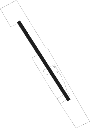
Runway info
| Runway 16 / 34 | ||
| length | 784m (2572ft) | |
| bearing | 148° / 328° | |
| width | 27m (90ft) | |
| surface | grass | |
Nearby beacons
| code | identifier | dist | bearing | frequency |
|---|---|---|---|---|
| BZ | BULLO (STATESBORO) NDB | 16.7 | 264° | 407 |
| JYL | SYLVANIA NDB | 17.7 | 308° | 245 |
| SAV | SAVANNAH VORTAC | 19.4 | 156° | 115.95 |
| SVN | HUNTER (SAVANNAH) VOR/DME | 28 | 156° | 111.60 |
| NBC | BEAUFORT TACAN | 31.4 | 87° | 110.50 |
| SV | WASSA (SAVANNAH) NDB | 32.1 | 142° | 335 |
| ALD | ALLENDALE VOR | 33.9 | 5° | 116.70 |
| MOQ | MC INTOSH (HINESVILLE) NDB | 38.1 | 196° | 263 |
| UQN | ONYUN (VIDALIA) NDB | 50.5 | 257° | 372 |
| AG | BUSHE (AUGUSTA) NDB | 58.9 | 324° | 233 |
Disclaimer
The information on this website is not for real aviation. Use this data with the X-Plane flight simulator only! Data taken with kind consent from X-Plane 12 source code and data files. Content is subject to change without notice.