Howick
Airport details
| Country | South Africa |
| State | KwaZulu-Natal |
| Region | FA |
| Airspace | Johannesburg Ctr |
| Municipality | uMgeni Local Municipality |
| Elevation | 3615ft (1102m) |
| Timezone | GMT +2 |
| Coordinates | -29.55276, 30.21115 |
| Magnetic var | |
| Type | land |
| Available since | X-Plane v10.40 |
| ICAO code | XFA000K |
| IATA code | n/a |
| FAA code | n/a |
Communication
| Howick ATC | 123.400 |
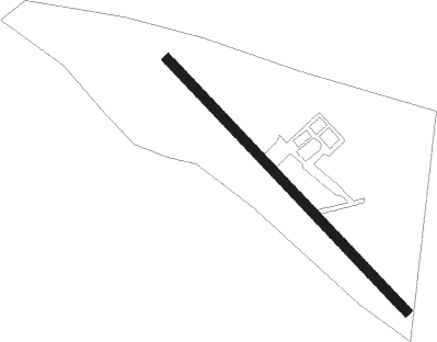
Runway info
| Runway 16 / 34 | ||
| length | 1221m (4006ft) | |
| bearing | 137° / 317° | |
| width | 35m (115ft) | |
| surface | grass | |
| displ threshold | 120m (394ft) / 35m (115ft) | |
Nearby beacons
| code | identifier | dist | bearing | frequency |
|---|---|---|---|---|
| OBI | PIETERMARITZBURG NDB | 10.2 | 107° | 280 |
| PMV | PIETERMARITZBURG VOR/DME | 11.4 | 117° | 117.90 |
| PU | PIETERMARITZBURG NDB | 12.2 | 119° | 407 |
| ORI | PIETERMARITZBURG NDB | 12.4 | 92° | 442 |
| PZ | PIETERMARITZBURG NDB | 15.4 | 123° | 257 |
| GYV | GREYTOWN VOR/DME | 32.3 | 41° | 113.50 |
| TGV | KING SHAKA (DURBAN) VOR/DME | 47.8 | 94° | 115.60 |
| LYV | LADYSMITH VOR/DME | 63 | 331° | 116.50 |
Disclaimer
The information on this website is not for real aviation. Use this data with the X-Plane flight simulator only! Data taken with kind consent from X-Plane 12 source code and data files. Content is subject to change without notice.