Airports for X-Plane offers a convenient way to explore airports and their related communication information for the X-Plane flight simulator. It only uses data from the X-Plane flight simulator itself, and is therefore more reliable than the data that comes from real aviation websites. You can search for airports by using the ICAO code, or browse for airports per country and state. The information displayed is categorized by airport details, runway information, airport communication, approach frequencies (ILS and Glidepath details), details of nearby beacons, SIDs, STARs and approach procedures.

luggage international airport heliport landing area arrival hangar runway faa airport authority asphalt arriving railway station flights aerodrome stopover commuter stolport taxi airspeed train station

Caerwys - Bryngwyn Bach

Airport details

CountryUnited Kingdom
StateWales
Region
AirspaceLondon Ctr
MunicipalitySt Asaph
Elevation643ft (196m)
TimezoneGMT +0
Coordinates53.26887, -3.36214
Magnetic var
Typeland
Available sinceX-Plane v10.40
ICAO codeXEG7BB
IATA coden/a
FAA coden/a

Communication

No airport communication available for XEG7BB
Nearby Points of Interest:
Cross In Churchyard Of The Church Of St Michael & All Angels
-
Bodrhyddan Hall
-
Golden Grove
-
Gyrn Castle
-
Mostyn Hall
-
Dolbelidr
-
Wigfair Hall
-
Plas Clough
-
Galltfaenan Hall
-
Church of St. Cwyfan
-
Holywell Workhouse Chapel
-
Foxhall Newydd
-
Royal Alexandra Hospital
-
Rhyl Town Hall
-
Holywell Junction railway station
-
North Wales Hospital
-
Kinmel Hall
-
Dee Estuary
-
Church of St Mary the Virgin, Halkyn
-
Rhydonnen
-
Alyn Valley Woods and Alyn Gorge Caves
-
Ty Coch Cruck Barn, Llangynhafal, Denbighshire
-
Town Hall, Market Square
-
Plas-y-Ward
-
Dee Cliffs

Runway info

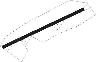
Runway 07 / 25
 length827m (2713ft)
 bearing77° / 257°
 width28m (92ft)
 surfacegrass

Airport layout


Nearby beacons

codeidentifierdistbearingfrequency
WALWALLASEY VOR/DME1162°114.10
HAWHAWARDEN NDB14.7103°340
LPLLIVERPOOL NDB23.284°349
WHIWHITEGATE NDB2796°368
BPLBLACKPOOL NDB32.534°318
WTNWARTON TACAN33.145°113.20
WTNWARTON NDB34.247°337
SWBSHAWBURY VOR/DME37.9124°116.80
WPLWELSHPOOL NDB39.1162°323
WLBARROW (WALNEY ISLAND) NDB51.6385

Disclaimer

The information on this website is not for real aviation. Use this data with the X-Plane flight simulator only! Data taken with kind consent from X-Plane 12 source code and data files. Content is subject to change without notice.