Wickede - Menden Barge
Airport details
| Country | Germany |
| State | North Rhine-Westphalia |
| Region | |
| Airspace | Langen Ctr |
| Municipality | Menden |
| Elevation | 673ft (205m) |
| Timezone | GMT +1 |
| Coordinates | 51.46107, 7.84089 |
| Magnetic var | |
| Type | land |
| Available since | X-Plane v10.40 |
| ICAO code | XEDEA |
| IATA code | n/a |
| FAA code | n/a |
Communication
| Menden Barge Menden Barge Info | 123.500 |
Nearby Points of Interest:
Museum Menden
-Pfarrhaus (Voßwinkel)
-Teufelsturm
-Saint Joseph Church
-Haus Kotten
-Altes Amtsgericht Neheim
-Schloss Dahlhausen
-Villa Westermann
-Beginenhof Deilinghofen
-Villa Prinz
-Amtshaus Hemer
-Fabrikantenhaus von der Becke
-Johanneskirche
-Westig railway station
-Amtsgericht Werl
-Haus Altendorf
-St. Joseph
-Historische Kornbrennerei Bimberg
-Werl Prison
-Villa Klute
-Bahnhof Lenningsen
-Villa Heutelbeck
-Villa Ebbinghaus-Möllmann
-Villa Wessel
-Wichelhovenhaus
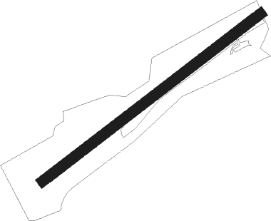
Runway info
| Runway 05 / 23 | ||
| length | 913m (2995ft) | |
| bearing | 68° / 248° | |
| width | 36m (118ft) | |
| surface | grass | |
Nearby beacons
| code | identifier | dist | bearing | frequency |
|---|---|---|---|---|
| DWI | DORTMUND-WICKEDE NDB | 8.6 | 287° | 357 |
| DOR | WICKEDE (DORTMUND) VOR/DME | 8.7 | 287° | 108.65 |
| GMH | GERMINGHAUSEN VOR/DME | 17.5 | 170° | 115.40 |
| HMM | HAMM VOR/DME | 24.2 | 341° | 115.65 |
| BAM | BARMEN VOR/DME | 26.1 | 259° | 114 |
| PAD | DME-ILS | 30.4 | 79° | 108.50 |
| PAD | PADERBORN-LIPPSTADT NDB | 31.3 | 79° | 354 |
| BOT | BOTTROP NDB | 31.4 | 279° | 406 |
| WYP | WIPPER VOR | 32.5 | 234° | 109.60 |
| LI | DUESSELDORF NDB | 36.2 | 263° | 417 |
| LW | COLOGNE-BONN NDB | 40.4 | 226° | 300 |
| MOD | DME | 41 | 347° | 114.05 |
| COL | COLA VOR/DME | 41.7 | 200° | 108.80 |
| MYN | MUENSTER/OSNABRUECK NDB | 41.9 | 357° | 371 |
| LJ | COLOGNE-BONN NDB | 43.4 | 236° | 365 |
| KBO | COLOGNE-BONN VOR/DME | 44.5 | 229° | 112.15 |
| LV | COLOGNE-BONN NDB | 45.4 | 222° | 327 |
| SLD | DME | 46.1 | 163° | 108.05 |
| OSB | OSNABRUCK TACAN | 47.3 | 31° | 108.35 |
| OSN | OSNABRUECK VOR | 47.3 | 31° | 114.30 |
| SIL | SIEGERLAND NDB | 48.2 | 159° | 489 |
Disclaimer
The information on this website is not for real aviation. Use this data with the X-Plane flight simulator only! Data taken with kind consent from X-Plane 12 source code and data files. Content is subject to change without notice.