Holzwickede - Hengsen-opherdicke
Airport details
| Country | Germany |
| State | North Rhine-Westphalia |
| Region | |
| Airspace | Langen Ctr |
| Municipality | Holzwickede |
| Elevation | 410ft (125m) |
| Timezone | GMT +1 |
| Coordinates | 51.47284, 7.64104 |
| Magnetic var | |
| Type | land |
| Available since | X-Plane v10.40 |
| ICAO code | XEDCU |
| IATA code | n/a |
| FAA code | n/a |
Communication
Nearby Points of Interest:
Historische Kornbrennerei Bimberg
-Haus Altendorf
-Schloss Dahlhausen
-Kreinberg
-Haus Villigst
-Jüdischer Friedhof (Schwerte)
-Schwerter Wald
-Amtshaus Aplerbeck
-Amtsgericht Schwerte
-Bergbaubeamtensiedlung Neu-Asseln
-Ruhrflutbrücke Ergste
-Eisenbahnbrücke Wandhofen
-Jüdischer Friedhof
-Haus Kotten
-Amtsgericht Unna
-Jüdischer Friedhof (Iserlohn)
-Villa Heutelbeck
-Gasometer Phoenix-West
-Villa Klute
-Villa Ebbinghaus-Möllmann
-Villa Wessel
-Museum Menden
-Wichelhovenhaus
-Schlieperblock
-Iserlohn City Library
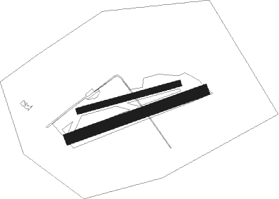
Runway info
Runway 08 / 26  | ||
| length | 598m (1962ft) | |
| bearing | 83° / 263° | |
| width | 35m (115ft) | |
| surface | grass | |
| Runway 07 / 25 | ||
| length | 828m (2717ft) | |
| bearing | 80° / 260° | |
| width | 65m (213ft) | |
| surface | grass | |
Nearby beacons
| code | identifier | dist | bearing | frequency |
|---|---|---|---|---|
| DOR | WICKEDE (DORTMUND) VOR/DME | 3.1 | 349° | 108.65 |
| DWI | DORTMUND-WICKEDE NDB | 3.2 | 353° | 357 |
| BAM | BARMEN VOR/DME | 19.4 | 253° | 114 |
| GMH | GERMINGHAUSEN VOR/DME | 20.4 | 140° | 115.40 |
| HMM | HAMM VOR/DME | 23.1 | 10° | 115.65 |
| BOT | BOTTROP NDB | 24 | 280° | 406 |
| WYP | WIPPER VOR | 28.8 | 220° | 109.60 |
| LI | DUESSELDORF NDB | 29 | 260° | 417 |
| DUS | DUESSELDORF VOR/DME | 35.1 | 258° | 115.15 |
| LW | COLOGNE-BONN NDB | 37.4 | 214° | 300 |
| PAD | DME-ILS | 37.4 | 82° | 108.50 |
| PAD | PADERBORN-LIPPSTADT NDB | 38.3 | 81° | 354 |
| LJ | COLOGNE-BONN NDB | 39.3 | 227° | 365 |
| DY | DUESSELDORF NDB | 39.6 | 256° | 284 |
| MOD | DME | 39.9 | 4° | 114.05 |
| KBO | COLOGNE-BONN VOR/DME | 41.1 | 219° | 112.15 |
| COL | COLA VOR/DME | 41.4 | 184° | 108.80 |
| MYN | MUENSTER/OSNABRUECK NDB | 41.6 | 13° | 371 |
| LV | COLOGNE-BONN NDB | 42.9 | 211° | 327 |
| SLD | DME | 48.8 | 150° | 108.05 |
| OSB | OSNABRUCK TACAN | 49.7 | 42° | 108.35 |
| OSN | OSNABRUECK VOR | 49.7 | 42° | 114.30 |
| SIL | SIEGERLAND NDB | 51.1 | 148° | 489 |
| RKN | DME | 51.3 | 307° | 116.80 |
| WNN | DME | 52.9 | 237° | 109.85 |
Disclaimer
The information on this website is not for real aviation. Use this data with the X-Plane flight simulator only! Data taken with kind consent from X-Plane 12 source code and data files. Content is subject to change without notice.