Königswinter - Eudenbach
Airport details
| Country | Germany |
| State | North Rhine-Westphalia |
| Region | |
| Airspace | Langen Ctr |
| Municipality | Königswinter |
| Elevation | 979ft (298m) |
| Timezone | GMT +1 |
| Coordinates | 50.67333, 7.36417 |
| Magnetic var | |
| Type | land |
| Available since | X-Plane v10.40 |
| ICAO code | XEDBX |
| IATA code | n/a |
| FAA code | n/a |
Communication
| Eudenbach Info Eudenbach | 118.425 |
Nearby Points of Interest:
Marienkapelle
-Backes
-Margarethenhof
-Hohenhonnef
-Feuerschlößchen
-Bischofshof
-Bismarckstraße 47
-Hontes
-Markt 6
-Ofenkaulen
-Kurhaus
-Haus Mayer-Kuckuk
-Ziegelei
-Kloster Merten
-Edelhoff-Stift
-Pottscheid
-Weinberghäuschen
-Wintermühlenhof
-Antoniuskapelle (Oberauel)
-Rheinstraße 16
-Haus Felseck
-Villa Genienau
-Uhlhof
-Am Lessing 6
-Amtsgericht Königswinter
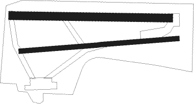
Runway info
Runway 08 / 26  | ||
| length | 952m (3123ft) | |
| bearing | 90° / 270° | |
| width | 30m (98ft) | |
| surface | grass | |
| Runway 09 / 27 | ||
| length | 951m (3120ft) | |
| bearing | 93° / 273° | |
| width | 50m (164ft) | |
| surface | grass | |
Nearby beacons
| code | identifier | dist | bearing | frequency |
|---|---|---|---|---|
| LV | COLOGNE-BONN NDB | 9.1 | 317° | 327 |
| COL | COLA VOR/DME | 10.9 | 64° | 108.80 |
| KBO | COLOGNE-BONN VOR/DME | 14 | 311° | 112.15 |
| LW | COLOGNE-BONN NDB | 14.1 | 334° | 300 |
| LJ | COLOGNE-BONN NDB | 19 | 310° | 365 |
| WYP | WIPPER VOR | 22.7 | 347° | 109.60 |
| SLD | DME | 27.2 | 87° | 108.05 |
| WNN | DME | 28.1 | 283° | 109.85 |
| NVO | NOERVENICH VORTAC | 29 | 282° | 116.20 |
| SIL | SIEGERLAND NDB | 29.4 | 90° | 489 |
| BUE | BUECHEL TACAN | 31.7 | 211° | 117.10 |
| GMH | GERMINGHAUSEN VOR/DME | 35.9 | 47° | 115.40 |
| TAU | TAUNUS VOR/DME | 39.7 | 118° | 113.35 |
| BAM | BARMEN VOR/DME | 39.9 | 344° | 114 |
| HAN | HAHN NDB | 42.6 | 187° | 376 |
| DY | DUESSELDORF NDB | 43 | 308° | 284 |
| DUS | DUESSELDORF VOR/DME | 43.2 | 315° | 115.15 |
| FHH | DME | 44.1 | 188° | 117.35 |
| LI | DUESSELDORF NDB | 44.2 | 325° | 417 |
| MHD | DME | 47.1 | 303° | 112.50 |
| MHV | MOENCHENGLADBACH VOR | 47.3 | 303° | 109.80 |
| SPA | SPANGDAHLEM TACAN | 48.9 | 224° | 109.50 |
| DOR | WICKEDE (DORTMUND) VOR/DME | 52.1 | 17° | 108.65 |
| DWI | DORTMUND-WICKEDE NDB | 52.2 | 18° | 357 |
| WIB | WIESBADEN TACAN | 52.2 | 124° | 114.10 |
| LMA | LIMA NDB | 55.6 | 306° | 311 |
| BOT | BOTTROP NDB | 56.2 | 340° | 406 |
Disclaimer
The information on this website is not for real aviation. Use this data with the X-Plane flight simulator only! Data taken with kind consent from X-Plane 12 source code and data files. Content is subject to change without notice.