Nideggen - Dueren Huertgenwald
Airport details
| Country | Germany |
| State | North Rhine-Westphalia |
| Region | |
| Airspace | Langen Ctr |
| Municipality | Hürtgenwald |
| Elevation | 1173ft (358m) |
| Timezone | GMT +1 |
| Coordinates | 50.69326, 6.41730 |
| Magnetic var | |
| Type | land |
| Available since | X-Plane v10.40 |
| ICAO code | XEDBO |
| IATA code | n/a |
| FAA code | n/a |
Communication
| Dueren Huertgenwald Info Huertgenwald | 123.355 |
Nearby Points of Interest:
Burg Berenstein
-Düsterkreuz
-Jüdischer Friedhof Untermaubach
-St. Albertus Magnus
-St. Christian
-Haus Gronau
-Jüdischer Friedhof
-St. Mariä Vermählung
-St. Georg
-St. Gereon
-Burg Hausen
-St. Johannes Nepomuk
-St. Fides, Spes, Caritas
-Pumpstation Berzbuir
-Hagelkreuz
-Zum Knipp 5
-Zum Knipp 1
-Bauschhof (Berzbuir)
-Gießereihalle Firma Eberhard Hoesch
-Hauptstraße 102
-Hüttenstraße 17
-Hauptstraße 80
-Weckshof
-Mehlmühle
-Alt St. Cyriakus
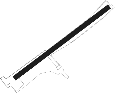
Runway info
| Runway 05 / 23 | ||
| length | 814m (2671ft) | |
| bearing | 68° / 248° | |
| width | 33m (109ft) | |
| surface | grass | |
Nearby beacons
| code | identifier | dist | bearing | frequency |
|---|---|---|---|---|
| NVO | NOERVENICH VORTAC | 11.3 | 59° | 116.20 |
| WNN | DME | 12.8 | 61° | 109.85 |
| GIX | GEILENKIRCHEN TACAN | 21.5 | 306° | 108.10 |
| SLV | SPA NDB | 23.1 | 247° | 386 |
| MAS | MAASTRICHT VOR/DME | 24 | 301° | 108.60 |
| LNO | OLNO VOR/DME | 27.6 | 261° | 112.80 |
| LJ | COLOGNE-BONN NDB | 28.2 | 70° | 365 |
| NW | MAASTRICHT NDB | 28.3 | 301° | 373 |
| KBO | COLOGNE-BONN VOR/DME | 29.4 | 77° | 112.15 |
| LV | COLOGNE-BONN NDB | 31.9 | 82° | 327 |
| SPI | SPRIMONT VOR/DME | 32 | 257° | 113.10 |
| MHD | DME | 32.6 | 8° | 112.50 |
| MHV | MOENCHENGLADBACH VOR | 32.7 | 8° | 109.80 |
| ONL | LIEGE NDB | 33 | 271° | 290 |
| DY | DUESSELDORF NDB | 33.7 | 24° | 284 |
| LW | COLOGNE-BONN NDB | 34 | 76° | 300 |
| LGE | LIEGE VOR/DME | 36.1 | 268° | 115.45 |
| DUS | DUESSELDORF VOR/DME | 37.6 | 30° | 115.15 |
| WYP | WIPPER VOR | 39 | 68° | 109.60 |
| BUE | BUECHEL TACAN | 39.7 | 128° | 117.10 |
| LMA | LIMA NDB | 40.7 | 358° | 311 |
| LI | DUESSELDORF NDB | 43.1 | 36° | 417 |
| SPA | SPANGDAHLEM TACAN | 44.2 | 159° | 109.50 |
| BBL | KLEINE BROGEL TACAN | 45.9 | 296° | 109.60 |
| BAM | BARMEN VOR/DME | 47.7 | 50° | 114 |
| DIK | DIEKIRCH NDB | 51.1 | 199° | 307 |
| HAN | HAHN NDB | 54.8 | 130° | 376 |
| LAA | NIEDERRHEIN NDB | 55.3 | 345° | 352 |
| NID | DME | 55.4 | 343° | 115.50 |
| FHH | DME | 55.5 | 132° | 117.35 |
| BOT | BOTTROP NDB | 58.2 | 34° | 406 |
| VKL | VOLKEL TACAN | 63.6 | 324° | 108.30 |
Disclaimer
The information on this website is not for real aviation. Use this data with the X-Plane flight simulator only! Data taken with kind consent from X-Plane 12 source code and data files. Content is subject to change without notice.