Erkelenz - Erkelenz - Kueckhoven Ul
Airport details
| Country | Germany |
| State | North Rhine-Westphalia |
| Region | |
| Airspace | Langen Ctr |
| Municipality | Erkelenz |
| Elevation | 279ft (85m) |
| Timezone | GMT +1 |
| Coordinates | 51.06350, 6.35603 |
| Magnetic var | |
| Type | land |
| Available since | X-Plane v10.40 |
| ICAO code | XED003S |
| IATA code | n/a |
| FAA code | n/a |
Communication
| Erkelenz - Kueckhoven UL Kueckhoven Info | 123.965 |
Nearby Points of Interest:
Ehemalige Gasthauskapelle Holzweiler
-Wegekreuz Heckstraße
-Kuckumer Straße 21
-An der Kirche 4
-Wegekreuz Hochstraße
-Church of St. Martin, Borschemich
-St. Lambertus
-Wegekreuz Wanlo
-Wegekreuz Heyers
-Wegekreuz Stahlenend
-Kinkelbach 17
-Kinkelbach 23
-Windmühle
-Bendhütter Straße 52
-Berger Dorfstraße 52
-Berger Dorfstraße 54
-Berger Dorfstraße 46
-Berger Dorfstraße 50/50a
-Berger Dorfstraße 53
-Berger Dorfstraße 55
-Berger Dorfstraße 42
-Berger Dorfstraße 35
-Auf dem Damm 14
-Kapelle Genholland
-Priorshof 1
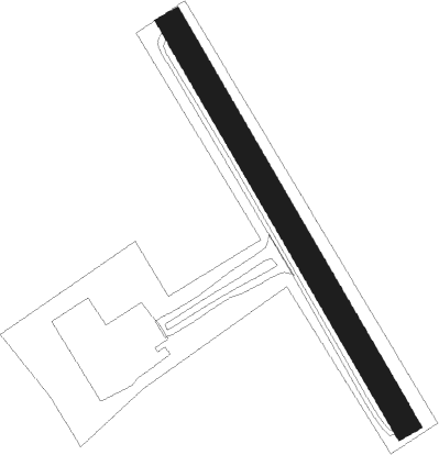
Runway info
| Runway 16 / 34 | ||
| length | 477m (1565ft) | |
| bearing | 143° / 323° | |
| width | 28m (91ft) | |
| surface | grass | |
Nearby beacons
| code | identifier | dist | bearing | frequency |
|---|---|---|---|---|
| MHD | DME | 11.4 | 38° | 112.50 |
| MHV | MOENCHENGLADBACH VOR | 11.5 | 38° | 109.80 |
| GIX | GEILENKIRCHEN TACAN | 13.1 | 252° | 108.10 |
| DY | DUESSELDORF NDB | 15.2 | 60° | 284 |
| MAS | MAASTRICHT VOR/DME | 15.9 | 257° | 108.60 |
| NVO | NOERVENICH VORTAC | 17.9 | 131° | 116.20 |
| WNN | DME | 18.1 | 126° | 109.85 |
| NW | MAASTRICHT NDB | 18.2 | 265° | 373 |
| LMA | LIMA NDB | 18.5 | 7° | 311 |
| DUS | DUESSELDORF VOR/DME | 19.9 | 61° | 115.15 |
| LI | DUESSELDORF NDB | 26.3 | 62° | 417 |
| LJ | COLOGNE-BONN NDB | 27.9 | 101° | 365 |
| KBO | COLOGNE-BONN VOR/DME | 32.2 | 104° | 112.15 |
| LAA | NIEDERRHEIN NDB | 33 | 341° | 352 |
| NID | DME | 33.2 | 338° | 115.50 |
| BBL | KLEINE BROGEL TACAN | 34.2 | 277° | 109.60 |
| BAM | BARMEN VOR/DME | 34.7 | 72° | 114 |
| WYP | WIPPER VOR | 34.8 | 91° | 109.60 |
| LW | COLOGNE-BONN NDB | 35.3 | 100° | 300 |
| LV | COLOGNE-BONN NDB | 36.9 | 106° | 327 |
| ONL | LIEGE NDB | 37.5 | 246° | 290 |
| LNO | OLNO VOR/DME | 37.7 | 234° | 112.80 |
| SLV | SPA NDB | 38.9 | 217° | 386 |
| BOT | BOTTROP NDB | 40.1 | 52° | 406 |
| LGE | LIEGE VOR/DME | 41.6 | 245° | 115.45 |
| VKL | VOLKEL TACAN | 43 | 312° | 108.30 |
| SPI | SPRIMONT VOR/DME | 43.1 | 233° | 113.10 |
| EHV | EINDHOVEN TACAN | 43.5 | 291° | 117.20 |
| BUE | BUECHEL TACAN | 59.6 | 141° | 117.10 |
| DLN | DEELEN TACAN | 62.3 | 334° | 112.20 |
Disclaimer
The information on this website is not for real aviation. Use this data with the X-Plane flight simulator only! Data taken with kind consent from X-Plane 12 source code and data files. Content is subject to change without notice.