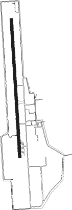
Sukhothai
Airport details
| Country | Thailand |
| State | Sukhothai Province |
| Region | VT |
| Airspace | Bangkok Ctr |
| Municipality | Nai Mueang |
| Elevation | 179ft (55m) |
| Timezone | GMT +7 |
| Coordinates | 17.23778, 99.81834 |
| Magnetic var | |
| Type | land |
| Available since | X-Plane v10.40 |
| ICAO code | VTPO |
| IATA code | THS |
| FAA code | n/a |
Communication
| Sukhothai Ground Control | 127.000 |
| Sukhothai Tower | 118.700 |
| Sukhothai PHITSANULOK Approach | 120.700 |
Approach frequencies
| ILS-cat-I | RW36 | 109.5 | 18.00mi |
| 3° GS | RW36 | 109.5 | 18.00mi |
Nearby beacons
| code | identifier | dist | bearing | frequency |
|---|---|---|---|---|
| THS | DME-ILS | 0.1 | 174° | 110.30 |
| THS | SUKHOTHAI NDB | 0.2 | 125° | 292 |
| PL | PHITSANULOK NDB | 37.3 | 134° | 263 |
| TK | TAK NDB | 38.3 | 239° | 332 |
| PSL | PHITSANULOK VOR/DME | 39 | 135° | 114.10 |
| PR | PHRAE NDB | 57 | 21° | 340 |
| PAE | PHRAE VOR/DME | 57.3 | 21° | 111.80 |
Departure and arrival routes
| Transition altitude | 11000ft |
| Transition level | 13000ft |
| SID end points | distance | outbound heading | |
|---|---|---|---|
| RW18 | |||
| KIME1A | 53mi | 183° | |
| TOPA1A | 28mi | 301° | |
| RW36 | |||
| KIME1B | 53mi | 183° | |
| TOPA1B | 28mi | 301° | |
Instrument approach procedures
| runway | airway (heading) | route (dist, bearing) |
|---|---|---|
| RW18 | AKTIK (149°) | AKTIK 5200ft UGEKO (8mi, 91°) 3500ft |
| RW18 | IGEMU (214°) | IGEMU 5200ft UGEKO (8mi, 271°) 3500ft |
| RW18 | OPELO (201°) | OPELO 9000ft UGEKO (18mi, 216°) 3500ft |
| RNAV | UGEKO 3500ft PO201 (6mi, 181°) 2300ft PO202 (7mi, 181°) 229ft (5968mi, 260°) 1700ft UGEKO (5968mi, 80°) 3500ft UGEKO (turn) 3500ft | |
| RW36 | IGEMU (214°) | IGEMU 5200ft GOSRU (25mi, 184°) 3500ft VASBI (7mi, 271°) 3000ft |
| RW36 | KIMET (11°) | KIMET 6000ft VASBI (13mi, 19°) 3000ft |
| RW36 | VEGTO (121°) | VEGTO 5200ft ATPAT (20mi, 166°) 5200ft VASBI (7mi, 91°) 3000ft |
| RNAV | VASBI 3000ft PO101 (5mi, 1°) 2300ft PO102 (7mi, 1°) 229ft (5968mi, 260°) 3700ft VEGTO (5956mi, 80°) 5200ft VEGTO (turn) 5200ft |
Disclaimer
The information on this website is not for real aviation. Use this data with the X-Plane flight simulator only! Data taken with kind consent from X-Plane 12 source code and data files. Content is subject to change without notice.
