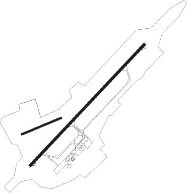
Kirov - Kirov Pobedilovo
Airport details
| Country | Russian Federation |
| State | Kirov Oblast |
| Region | US |
| Airspace | Yekaterinburg Ctr |
| Municipality | городской округ Киров |
| Elevation | 484ft (148m) |
| Timezone | GMT +3 |
| Coordinates | 58.50361, 49.34694 |
| Magnetic var | |
| Type | land |
| Available since | X-Plane v10.40 |
| ICAO code | USKK |
| IATA code | KVX |
| FAA code | n/a |
Communication
| Kirov Pobedilovo ATIS | 134.900 |
| Kirov Pobedilovo Tower | 118.600 |
| Kirov Pobedilovo Approach | 127.500 |
Approach frequencies
| ILS-cat-I | RW03 | 109.3 | 18.00mi |
| ILS-cat-I | RW21 | 109.9 | 18.00mi |
| 3° GS | RW03 | 109.3 | 18.00mi |
| 3° GS | RW21 | 109.9 | 18.00mi |
Nearby Points of Interest:
Kirov Regional Scientific Library
-House of Soviets, Kirov
-Vyatka men's gymnasium
-Saint Seraphim Church, Kirov

Nearby beacons
| code | identifier | dist | bearing | frequency |
|---|---|---|---|---|
| KF | DME | 0.1 | 308° | 110.60 |
| O | POBEDILOVO (KIROV) NDB | 1.2 | 244° | 213 |
| X | POBEDILOVO (KIROV) NDB | 1.2 | 65° | 213 |
| OR | POBEDILOVO (KIROV) NDB | 2.7 | 244° | 438 |
| XA | POBEDILOVO (KIROV) NDB | 2.7 | 65° | 438 |
Departure and arrival routes
| Transition altitude | 2782ft |
| SID end points | distance | outbound heading | |
|---|---|---|---|
| RW03 | |||
| NIBO1G, NIBO1C | 26mi | 26° | |
| KURU1C, KURU1G | 27mi | 85° | |
| TEGR1G, TEGR1C | 27mi | 131° | |
| ASTA1G, ASTA1C | 27mi | 230° | |
| LESO1C, LESO1G | 22mi | 276° | |
| ABKO1C, ABKO1G | 24mi | 327° | |
| RW21 | |||
| NIBO1H, NIBO1D | 26mi | 26° | |
| KURU1H, KURU1D | 27mi | 85° | |
| TEGR1D, TEGR1H | 27mi | 131° | |
| ASTA1D, ASTA1H | 27mi | 230° | |
| LESO1D, LESO1H | 22mi | 276° | |
| ABKO1H, ABKO1D | 24mi | 327° | |
| STAR starting points | distance | inbound heading | |
|---|---|---|---|
| RW03 | |||
| ASTA1A, ASTA1L, ASTA2L | 26.9 | 50° | |
| LESO1L, LESO1A | 22.3 | 96° | |
| OGID1A, OGID1L | 22.9 | 118° | |
| ABKO1A, ABKO1L | 24.0 | 147° | |
| NIBO1L, NIBO1A | 25.9 | 206° | |
| KURU1L, KURU1A | 26.9 | 265° | |
| FUKA1L, FUKA1A | 26.9 | 288° | |
| RW21 | |||
| ASTA1M, ASTA1B | 26.9 | 50° | |
| LESO1M, LESO1B | 22.3 | 96° | |
| OGID1B, OGID1M | 22.9 | 118° | |
| ABKO1M, ABKO1B | 24.0 | 147° | |
| NIBO1M, NIBO1B | 25.9 | 206° | |
| KURU1B, KURU1M | 26.9 | 265° | |
| FUKA1M, FUKA1B | 26.9 | 288° | |
Instrument approach procedures
| runway | airway (heading) | route (dist, bearing) |
|---|---|---|
| RW03 | KK003 (34°) | KK003 KK004 (6mi, 300°) |
| RW03 | KK006 (82°) | KK006 KK004 (6mi, 120°) |
| RNAV | KK004 1790ft KK002 (6mi, 64°) 1790ft USKK (5mi, 65°) 520ft KK007 (4mi, 66°) 1460ft KK013 (11mi, 283°) 2440ft KK006 (11mi, 222°) | |
| RW21 | KK009 (224°) | KK009 KK010 (6mi, 120°) |
| RW21 | KK011 (259°) | KK011 KK010 (6mi, 300°) |
| RNAV | KK010 2440ft KK008 (10mi, 245°) 1780ft USKK (5mi, 245°) 513ft KK012 (4mi, 244°) 1450ft KK015 (11mi, 345°) 2440ft KK009 (13mi, 74°) |
Holding patterns
| STAR name | hold at | type | turn | heading* | altitude | leg | speed limit |
|---|---|---|---|---|---|---|---|
| ABKO1A | OR | FIX | left | 213 (33)° | 1790ft - 6000ft | 1.0min timed | 250 |
| ABKO1B | XA | FIX | right | 33 (213)° | 2110ft - 6000ft | 1.0min timed | 250 |
| ABKO1L | KK006 | VHF | right | 357 (177)° | 2440ft - 10000ft | 1.0min timed | 230 |
| ABKO1M | KK009 | VHF | left | 246 (66)° | 2440ft - 10000ft | 1.0min timed | 230 |
| ASTA1A | OR | FIX | left | 213 (33)° | 1790ft - 6000ft | 1.0min timed | 250 |
| ASTA1B | XA | FIX | right | 33 (213)° | 2110ft - 6000ft | 1.0min timed | 250 |
| ASTA1L | KK003 | VHF | left | 123 (303)° | 2440ft - 10000ft | 1.0min timed | 230 |
| FUKA1A | OR | FIX | left | 213 (33)° | 1790ft - 6000ft | 1.0min timed | 250 |
| FUKA1B | XA | FIX | right | 33 (213)° | 2110ft - 6000ft | 1.0min timed | 250 |
| FUKA1L | KK003 | VHF | left | 123 (303)° | 2440ft - 10000ft | 1.0min timed | 230 |
| KURU1A | OR | FIX | left | 213 (33)° | 1790ft - 6000ft | 1.0min timed | 250 |
| KURU1B | XA | FIX | right | 33 (213)° | 2110ft - 6000ft | 1.0min timed | 250 |
| KURU1L | KK003 | VHF | left | 123 (303)° | 2440ft - 10000ft | 1.0min timed | 230 |
| LESO1A | OR | FIX | left | 213 (33)° | 1790ft - 6000ft | 1.0min timed | 250 |
| LESO1B | XA | FIX | right | 33 (213)° | 2110ft - 6000ft | 1.0min timed | 250 |
| LESO1L | KK006 | VHF | right | 357 (177)° | 2440ft - 10000ft | 1.0min timed | 230 |
| LESO1M | KK009 | VHF | left | 246 (66)° | 2440ft - 10000ft | 1.0min timed | 230 |
| NIBO1A | OR | FIX | left | 213 (33)° | 1790ft - 6000ft | 1.0min timed | 250 |
| NIBO1B | XA | FIX | right | 33 (213)° | 2110ft - 6000ft | 1.0min timed | 250 |
| NIBO1L | KK006 | VHF | right | 357 (177)° | 2440ft - 10000ft | 1.0min timed | 230 |
| NIBO1M | KK009 | VHF | left | 246 (66)° | 2440ft - 10000ft | 1.0min timed | 230 |
| OGID1A | OR | FIX | left | 213 (33)° | 1790ft - 6000ft | 1.0min timed | 250 |
| OGID1B | XA | FIX | right | 33 (213)° | 2110ft - 6000ft | 1.0min timed | 250 |
| OGID1L | KK006 | VHF | right | 357 (177)° | 2440ft - 10000ft | 1.0min timed | 230 |
| OGID1M | KK009 | VHF | left | 246 (66)° | 2440ft - 10000ft | 1.0min timed | 230 |
| *) magnetic outbound (inbound) holding course | |||||||
Disclaimer
The information on this website is not for real aviation. Use this data with the X-Plane flight simulator only! Data taken with kind consent from X-Plane 12 source code and data files. Content is subject to change without notice.