Kiunga
Airport details
| Country | Papua New Guinea |
| State | Western |
| Region | AY |
| Airspace | Port Moresby Ctr |
| Municipality | Kiunga District |
| Elevation | 102ft (31m) |
| Timezone | GMT +10 |
| Coordinates | -6.12770, 141.27812 |
| Magnetic var | |
| Type | land |
| Available since | X-Plane v10.40 |
| ICAO code | UNG |
| IATA code | UNG |
| FAA code | n/a |
Communication
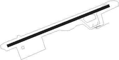
Runway info
| Runway 07 / 25 | ||
| length | 1201m (3940ft) | |
| bearing | 73° / 253° | |
| width | 30m (98ft) | |
| surface | gravel | |
| blast zone | 60m (197ft) / 60m (197ft) | |
Nearby beacons
| code | identifier | dist | bearing | frequency |
|---|---|---|---|---|
| OKT | OK TEDI NDB | 43.1 | 3° | 16.320 |
Disclaimer
The information on this website is not for real aviation. Use this data with the X-Plane flight simulator only! Data taken with kind consent from X-Plane 12 source code and data files. Content is subject to change without notice.