Ambrolauri
Airport details
| Country | Georgia |
| State | Racha-Lechkhumi and Lower Svaneti |
| Region | |
| Airspace | Tbilisi Ctr |
| Municipality | Ambrolauri Municipality |
| Elevation | 1784ft (544m) |
| Timezone | GMT +4 |
| Coordinates | 42.52696, 43.13537 |
| Magnetic var | |
| Type | land |
| Available since | X-Plane v10.32 |
| ICAO code | UGAM |
| IATA code | n/a |
| FAA code | n/a |
Communication
| Ambrolauri Ambrolauri Info | 119.850 |
Nearby Points of Interest:
Mghvimevi monastery
-Katskhi Monastery
-Savane church
-Speti church of the Savior
-Ekhvevi church
-Upper Svaneti
-Lagurka
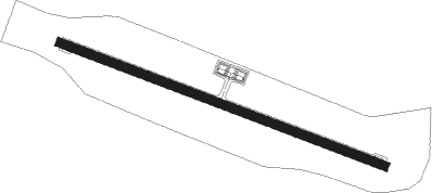
Runway info
| Runway 11 / 29 | ||
| length | 1099m (3606ft) | |
| bearing | 109° / 289° | |
| width | 30m (98ft) | |
| surface | asphalt | |
Nearby beacons
| code | identifier | dist | bearing | frequency |
|---|---|---|---|---|
| UY | KUTAISI NDB | 33.3 | 240° | 842 |
| BT | ALI NDB | 34.8 | 130° | 353 |
| KTS | KUTAISI VOR/DME | 35.7 | 242° | 113.60 |
| BKU | DME | 53.1 | 154° | 110.60 |
| N | NALCHIK NDB | 64 | 28° | 350 |
Disclaimer
The information on this website is not for real aviation. Use this data with the X-Plane flight simulator only! Data taken with kind consent from X-Plane 12 source code and data files. Content is subject to change without notice.