Cal Black Memorial
Airport details
| Country | United States of America |
| State | Utah |
| Region | K2 |
| Airspace | Denver Ctr |
| Municipality | San Juan County |
| Elevation | 4388ft (1337m) |
| Timezone | GMT -7 |
| Coordinates | 37.43530, -110.56429 |
| Magnetic var | |
| Type | land |
| Available since | X-Plane v10.40 |
| ICAO code | U96 |
| IATA code | n/a |
| FAA code | n/a |
Communication
| CAL BLACK MEMORIAL AWOS 3 | 134.375 |
| CAL BLACK MEMORIAL CTAF/UNICOM | 123.000 |
| CAL BLACK MEMORIAL AI Tower | 128.800 |
Nearby Points of Interest:
Goulding's Trading Post
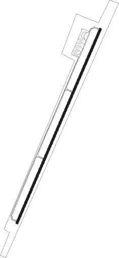
Runway info
| Runway 1 / 19 | ||
| length | 1741m (5712ft) | |
| bearing | 34° / 214° | |
| width | 18m (60ft) | |
| surface | asphalt | |
Nearby beacons
| code | identifier | dist | bearing | frequency |
|---|---|---|---|---|
| PGA | PAGE VOR/DME | 51.9 | 240° | 117.60 |
| HVE | HANKSVILLE VORTAC | 59.2 | 352° | 115.90 |
Disclaimer
The information on this website is not for real aviation. Use this data with the X-Plane flight simulator only! Data taken with kind consent from X-Plane 12 source code and data files. Content is subject to change without notice.