Mason - Mason County
Airport details
| Country | United States of America |
| State | Texas |
| Region | K4 |
| Airspace | Houston Oceanic Ctr |
| Municipality | Mason County |
| Elevation | 1500ft (457m) |
| Timezone | GMT -6 |
| Coordinates | 30.73219, -99.18401 |
| Magnetic var | |
| Type | land |
| Available since | X-Plane v10.40 |
| ICAO code | T92 |
| IATA code | n/a |
| FAA code | n/a |
Communication
| Mason County CTAF | 122.900 |
| Mason County HOUSTON CNTR | 132.350 |
Nearby Points of Interest:
Mason Historic District
-Cherry Spring School
-Crabapple School
-Old McCulloch County Jail
-Llano County Courthouse and Jail
-McCulloch County Courthouse
-Badu Building
-Fredericksburg Historic District
-Fredericksburg Memorial Library
-Frank Van Der Stucken Birthplace
-Hoerster Building
-HA. 19
-Wrede School
-Presidio San Luis de las Amarillas
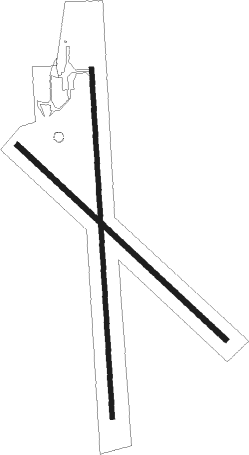
Runway info
Runway 18 / 36  | ||
| length | 1136m (3727ft) | |
| bearing | 181° / 1° | |
| width | 15m (50ft) | |
| surface | asphalt | |
| Runway 13 / 31 | ||
| length | 927m (3041ft) | |
| bearing | 133° / 313° | |
| width | 18m (60ft) | |
| surface | grass | |
Nearby beacons
| code | identifier | dist | bearing | frequency |
|---|---|---|---|---|
| LLO | LLANO VORTAC | 20.8 | 81° | 108.20 |
| JCT | JUNCTION VORTAC | 33.7 | 258° | 116 |
| STV | STONEWALL VORTAC | 40.1 | 138° | 113.80 |
| CSI | CENTER POINT (KERRVILLE) VORTAC | 48.6 | 182° | 117.50 |
Instrument approach procedures
| runway | airway (heading) | route (dist, bearing) |
|---|---|---|
| RW18 | WODIR (181°) | WODIR 3800ft |
| RNAV | WODIR 3800ft FEGIP (7mi, 181°) 3100ft OZEYI (2mi, 181°) 2380ft T92 (3mi, 181°) 1542ft (5879mi, 107°) 1914ft UCOBA (5880mi, 287°) 3800ft UCOBA (turn) | |
| RW36 | UCOBA (1°) | UCOBA 3800ft |
| RNAV | UCOBA 3800ft JUTGU (6mi, 1°) 3100ft EWETO (2mi, 1°) 2320ft T92 (3mi, 2°) 1538ft (5879mi, 107°) 1914ft WODIR (5878mi, 287°) 3800ft WODIR (turn) |
Disclaimer
The information on this website is not for real aviation. Use this data with the X-Plane flight simulator only! Data taken with kind consent from X-Plane 12 source code and data files. Content is subject to change without notice.