Rancagua - De La Independencia
Airport details
| Country | Chile |
| State | O'Higgins Region |
| Region | SC |
| Airspace | Santiago Ctr |
| Municipality | Rancagua |
| Elevation | 1597ft (487m) |
| Timezone | GMT -4 |
| Coordinates | -34.16739, -70.77073 |
| Magnetic var | |
| Type | land |
| Available since | X-Plane v10.40 |
| ICAO code | SCRG |
| IATA code | QRC |
| FAA code | n/a |
Communication
| De La Independencia Tower | 118.650 |
Nearby Points of Interest:
Plazuela Marcelino Champagnat
-Plaza de los Héroes de Rancagua
-Gobernación Provincial de Cachapoal
-Casa patronal del fundo El Puente
-Población Errázuriz de Coya
-Iglesia del Tránsito de la Santísima Virgen María
-Cárcel de San Fernando
-Ruedas de Larmahue
-Huaca de Chena
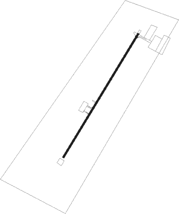
Runway info
| Runway 03 / 21 | ||
| length | 1687m (5535ft) | |
| bearing | 41° / 221° | |
| width | 23m (75ft) | |
| surface | asphalt | |
| blast zone | 170m (558ft) / 0m (0ft) | |
Nearby beacons
| code | identifier | dist | bearing | frequency |
|---|---|---|---|---|
| BQE | EL BOSQUE VOR/DME | 36.4 | 8° | 117.50 |
| AMB | SANTIAGO VOR/DME | 44.9 | 359° | 116.10 |
| PDH | PUDAHUEL (SANTIAGO) VOR/DME | 45.2 | 358° | 117.20 |
| DGO | DOMINGO VOR/DME | 52 | 301° | 112.30 |
| SNO | SANTO DOMINGO NDB | 52.1 | 302° | 355 |
| ICO | CURICO VOR/DME | 52.8 | 209° | 114.70 |
Disclaimer
The information on this website is not for real aviation. Use this data with the X-Plane flight simulator only! Data taken with kind consent from X-Plane 12 source code and data files. Content is subject to change without notice.