Cunco - Los Guayes
Airport details
| Country | Chile |
| State | Araucanía Region |
| Region | SC |
| Airspace | Puerto Montt Ctr |
| Municipality | Cunco |
| Elevation | 1312ft (400m) |
| Timezone | GMT -3 |
| Coordinates | -39.05305, -71.99361 |
| Magnetic var | |
| Type | land |
| Available since | X-Plane v10.40 |
| ICAO code | SCGY |
| IATA code | n/a |
| FAA code | n/a |
Communication
Nearby Points of Interest:
Sitio de Villarrica
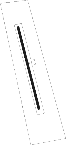
Runway info
| Runway 17 / 35 | ||
| length | 599m (1965ft) | |
| bearing | 167° / 347° | |
| width | 18m (59ft) | |
| surface | grass | |
Nearby beacons
| code | identifier | dist | bearing | frequency |
|---|---|---|---|---|
| NIA | ARAUCANIA (FREIRE) VOR/DME | 31.6 | 283° | 114 |
| CHP | SAN MARTIN DE LOS ANDES VOR/DME | 72.8 | 138° | 117 |
Disclaimer
The information on this website is not for real aviation. Use this data with the X-Plane flight simulator only! Data taken with kind consent from X-Plane 12 source code and data files. Content is subject to change without notice.