Contao
Airport details
| Country | Chile |
| State | Los Lagos Region |
| Region | SC |
| Airspace | Puerto Montt Ctr |
| Municipality | Hualaihué |
| Elevation | 15ft (5m) |
| Timezone | GMT -3 |
| Coordinates | -41.79972, -72.72250 |
| Magnetic var | |
| Type | land |
| Available since | X-Plane v10.40 |
| ICAO code | SCCK |
| IATA code | n/a |
| FAA code | n/a |
Communication
Nearby Points of Interest:
Bosque fósil de Punta Pelluco
-Casa Pauly
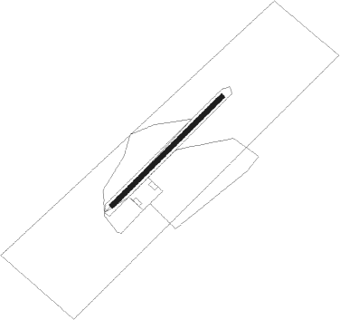
Runway info
| Runway 06 / 24 | ||
| length | 598m (1962ft) | |
| bearing | 58° / 238° | |
| width | 18m (59ft) | |
| surface | gravel | |
Nearby beacons
| code | identifier | dist | bearing | frequency |
|---|---|---|---|---|
| MON | PUERTO MONTT VOR/DME | 27.7 | 315° | 115.70 |
| MPI | MOCOPULLI VOR/DME | 54.8 | 241° | 113.30 |
| TEN | CHAITEN VOR/DME | 59.7 | 187° | 112.30 |
Disclaimer
The information on this website is not for real aviation. Use this data with the X-Plane flight simulator only! Data taken with kind consent from X-Plane 12 source code and data files. Content is subject to change without notice.