Belo Horizonte - Carlos Prates - Bh
Airport details
| Country | Brazil |
| State | Minas Gerais |
| Region | SB |
| Airspace | Brasilia Ctr |
| Municipality | Belo Horizonte |
| Elevation | 3041ft (927m) |
| Timezone | GMT -3 |
| Coordinates | -19.91045, -43.98636 |
| Magnetic var | |
| Type | land |
| Available since | X-Plane v10.40 |
| ICAO code | SBPR |
| IATA code | n/a |
| FAA code | n/a |
Communication
| Carlos Prates - BH BELO HORIZONTE ATIS | 127.450 |
| Carlos Prates - BH RDO | 125.850 |
Nearby Points of Interest:
Casa da Fazenda do Leitão
-Saint Joseph Church (Belo Horizonte)
-Academy of Letters of Minas Gerais
-Praça da Liberdade
-Palácio da Liberdade
-Pampulha Modern Ensemble
-Serra do Curral
-Solar do Padre Correia
-Parish Church of Our Lady of the Conception
-Parish Church of Our Lady of Good Success
-Museu Regional de Caeté
-Shrine of Our Lady of Piety
-Gongo Soco
-Quinta do Sumidouro
-house of Doctor Augusto Gonçalves de Souza Moreira
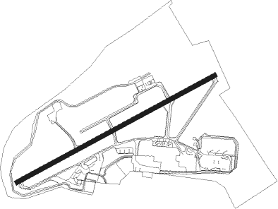
Runway info
| Runway 09 / 27 | ||
| length | 920m (3018ft) | |
| bearing | 67° / 247° | |
| width | 18m (59ft) | |
| surface | asphalt | |
Nearby beacons
| code | identifier | dist | bearing | frequency |
|---|---|---|---|---|
| BHZ | BELO HORIZONTE VOR/DME | 4.5 | 347° | 117.70 |
| LST | LAGOA SANTA NDB | 15.9 | 20° | 295 |
| CNF | CONFINS (BELO HORIZONTE) VOR/DME | 21.4 | 350° | 114.40 |
| PMI | DE MINAS DME | 35.2 | 276° | 113.70 |
Disclaimer
The information on this website is not for real aviation. Use this data with the X-Plane flight simulator only! Data taken with kind consent from X-Plane 12 source code and data files. Content is subject to change without notice.