Lagoa Santa
Airport details
| Country | Brazil |
| State | Minas Gerais |
| Region | SB |
| Airspace | Brasilia Ctr |
| Municipality | Lagoa Santa |
| Elevation | 2792ft (851m) |
| Timezone | GMT -3 |
| Coordinates | -19.66111, -43.89778 |
| Magnetic var | |
| Type | land |
| Available since | X-Plane v10.40 |
| ICAO code | SBLS |
| IATA code | n/a |
| FAA code | n/a |
Communication
| Lagoa Santa RDO | 122.800 |
Nearby Points of Interest:
Quinta do Sumidouro
-Pampulha Modern Ensemble
-Solar do Padre Correia
-Saint Joseph Church (Belo Horizonte)
-Shrine of Our Lady of Piety
-Academy of Letters of Minas Gerais
-Praça da Liberdade
-Palácio da Liberdade
-Casa da Fazenda do Leitão
-Serra do Curral
-Parish Church of Our Lady of the Conception
-Museu Regional de Caeté
-Parish Church of Our Lady of Good Success
-Gongo Soco
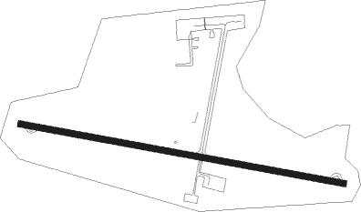
Runway info
| Runway 13 / 31 | ||
| length | 1842m (6043ft) | |
| bearing | 104° / 284° | |
| width | 36m (118ft) | |
| surface | asphalt | |
Nearby beacons
| code | identifier | dist | bearing | frequency |
|---|---|---|---|---|
| LST | LAGOA SANTA NDB | 0.1 | 21° | 295 |
| CNF | CONFINS (BELO HORIZONTE) VOR/DME | 10.5 | 304° | 114.40 |
| BHZ | BELO HORIZONTE VOR/DME | 12 | 211° | 117.70 |
| PMI | DE MINAS DME | 41.5 | 256° | 113.70 |
| CVO | DME | 63.3 | 329° | 113.40 |
Departure and arrival routes
| Transition altitude | 6000ft |
| SID end points | distance | outbound heading | |
|---|---|---|---|
| RW13 | |||
| ISNU1A, SINE1A | 81mi | 82° | |
| KUBE1A | 55mi | 108° | |
| ISLE1A, MUGR1A | 44mi | 268° | |
| TORU1A, SUBR1A | 44mi | 323° | |
| RW31 | |||
| SINE1A, ISNU1A | 81mi | 82° | |
| KUBE1A | 55mi | 108° | |
| MUGR1A, ISLE1A | 44mi | 268° | |
| SUBR1A, TORU1A | 44mi | 323° | |
Instrument approach procedures
| runway | airway (heading) | route (dist, bearing) |
|---|---|---|
| RW13 | LS003 (104°) | LS003 5000ft LS004 (5mi, 104°) 4600ft |
| RNAV | LS004 4600ft LS005 (5mi, 104°) 4410ft SBLS (5mi, 103°) 2810ft (2839mi, 66°) 3800ft CF033 (2827mi, 246°) 7000ft CF033 (turn) 7000ft | |
| RW31 | LS015 (284°) | LS015 7000ft LS016 (5mi, 284°) 4800ft |
| RNAV | LS016 4800ft LS017 (5mi, 284°) 4440ft LS022 (2mi, 284°) 3745ft SBLS (3mi, 284°) 2840ft BH014 (27mi, 284°) 7000ft BH014 (turn) 7000ft |
Disclaimer
The information on this website is not for real aviation. Use this data with the X-Plane flight simulator only! Data taken with kind consent from X-Plane 12 source code and data files. Content is subject to change without notice.