Wainwright
Airport details
| Country | United States of America |
| State | Alaska |
| Region | PA |
| Municipality | Wainwright |
| Elevation | 41ft (12m) |
| Timezone | GMT -9 |
| Coordinates | 70.63800, -159.99475 |
| Magnetic var | |
| Type | land |
| Available since | X-Plane v10.40 |
| ICAO code | PAWI |
| IATA code | AIN |
| FAA code | AWI |
Communication
| Wainwright ASOS | 132.250 |
| Wainwright CTAF | 122.800 |
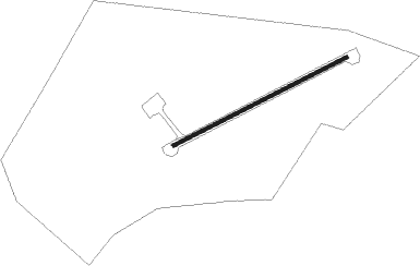
Runway info
| Runway 05 / 23 | ||
| length | 1364m (4475ft) | |
| bearing | 82° / 262° | |
| width | 27m (89ft) | |
| surface | gravel | |
| blast zone | 76m (249ft) / 76m (249ft) | |
Nearby beacons
| code | identifier | dist | bearing | frequency |
|---|---|---|---|---|
| UKK | WAINWRIGHT VILLAGE NDB | 0.2 | 268° | 338 |
Instrument approach procedures
| runway | airway (heading) | route (dist, bearing) |
|---|---|---|
| RW06 | CUTGU (93°) | CUTGU OZYIB (8mi, 128°) 2000ft |
| RW06 | OZYIB (82°) | OZYIB 2000ft |
| RW06 | RIROQ (66°) | RIROQ OZYIB (8mi, 308°) 2000ft |
| RNAV | OZYIB 2000ft TECWA (8mi, 82°) 1700ft PAWI (5mi, 82°) 87ft (6495mi, 114°) 295ft MEXIW (6486mi, 294°) 2000ft MEXIW (turn) | |
| RW24 | HOPUM (246°) | HOPUM MEXIW (8mi, 129°) 2000ft |
| RW24 | MEXIW (262°) | MEXIW 2000ft |
| RW24 | NEMCU (273°) | NEMCU MEXIW (8mi, 310°) 2000ft |
| RNAV | MEXIW 2000ft TOPQI (8mi, 262°) 1700ft PAWI (5mi, 262°) 85ft (6495mi, 114°) 295ft OZYIB (6504mi, 294°) 2000ft OZYIB (turn) |
Disclaimer
The information on this website is not for real aviation. Use this data with the X-Plane flight simulator only! Data taken with kind consent from X-Plane 12 source code and data files. Content is subject to change without notice.