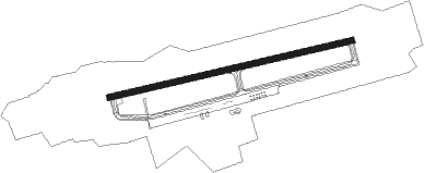
Valdez - Valdez Pioneer Fld
Airport details
| Country | United States of America |
| State | Alaska |
| Region | PA |
| Municipality | Valdez |
| Elevation | 118ft (36m) |
| Timezone | GMT -9 |
| Coordinates | 61.13422, -146.24477 |
| Magnetic var | |
| Type | land |
| Available since | X-Plane v10.40 |
| ICAO code | PAVD |
| IATA code | VDZ |
| FAA code | VDZ |
Communication
| Valdez Pioneer Fld AWOS 3 | 118.800 |
| Valdez Pioneer Fld CTAF | 122.900 |
Approach frequencies
| LDA | RW06 | 109.5 | 18.00mi |
Nearby beacons
| code | identifier | dist | bearing | frequency |
|---|---|---|---|---|
| MNL | MINERAL CREEK (VALDEZ) NDB | 3.1 | 265° | 524 |
| ALJ | ORCA BAY (HINCHINBROOK) NDB | 40.5 | 208° | 233 |
| JOH | JOHNSTONE POINT VOR/DME | 40.5 | 208° | 116.70 |
| GCR | GLACIER RIVER (CORDOVA) NDB | 44.3 | 130° | 404 |
Departure and arrival routes
| Transition altitude | 18000ft |
| Transition level | 18000ft |
| SID end points | distance | outbound heading | |
|---|---|---|---|
| ALL | |||
| NAKED6 | 45mi | 246° | |
| RW06 | |||
| JMAAL3 | 45mi | 246° | |
| RW24 | |||
| JOH2 | 41mi | 208° | |
| JMAAL3 | 45mi | 246° | |
| FJORD1 | 90mi | 268° | |
Instrument approach procedures
| runway | airway (heading) | route (dist, bearing) |
|---|---|---|
| RWNVB | JOH (28°) | JOH GOCNE (18mi, 293°) 2700ft |
| RWNVB | NAKED (66°) | NAKED GOCNE (10mi, 80°) 2700ft |
| RNAV | GOCNE 2700ft FILAP (6mi, 48°) 1500ft HEBEN (5mi, 48°) 1200ft NAKED (20mi, 246°) 5000ft NAKED (turn) |
Disclaimer
The information on this website is not for real aviation. Use this data with the X-Plane flight simulator only! Data taken with kind consent from X-Plane 12 source code and data files. Content is subject to change without notice.