Parakai
Airport details
| Country | New Zealand |
| State | Auckland |
| Region | NZ |
| Municipality | Rodney |
| Elevation | 4ft (1m) |
| Timezone | GMT +13 |
| Coordinates | -36.65167, 174.43333 |
| Magnetic var | |
| Type | land |
| Available since | X-Plane v10.40 |
| ICAO code | NZPI |
| IATA code | n/a |
| FAA code | n/a |
Communication
Nearby Points of Interest:
Gluepot Tavern
-Dilworth Building
-Bluestone Store
-Auckland Savings Bank Building
-Auckland Town Hall
-Kenneth Myers Centre
-Albert Barracks Wall
-Stoneways
-Auckland volcanic field
-Pah Homestead
-Chapel of St John the Evangelist, Auckland
-Smelting House ruins
-Ruatuna
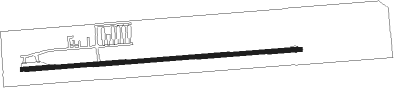
Runway info
| Runway 07 / 25 | ||
| length | 737m (2418ft) | |
| bearing | 90° / 270° | |
| width | 10m (33ft) | |
| surface | asphalt | |
Nearby beacons
| code | identifier | dist | bearing | frequency |
|---|---|---|---|---|
| WP | WHENUAPAI (AUCKLAND) VOR/DME | 12.5 | 124° | 116.40 |
| AA | AUCKLAND VOR/DME | 27.9 | 133° | 114.80 |
| WI | WAIUKU NDB | 41.2 | 148° | 254 |
| SF | SPRINGFIELD (WHANGAREI) NDB | 46.1 | 354° | 366 |
| SY | SURREY NDB | 49.8 | 129° | 350 |
| WR | WHANGAREI NDB | 52.9 | 355° | 326 |
Disclaimer
The information on this website is not for real aviation. Use this data with the X-Plane flight simulator only! Data taken with kind consent from X-Plane 12 source code and data files. Content is subject to change without notice.